MyTopo
Roxbury Virginia US Topo Map
Couldn't load pickup availability
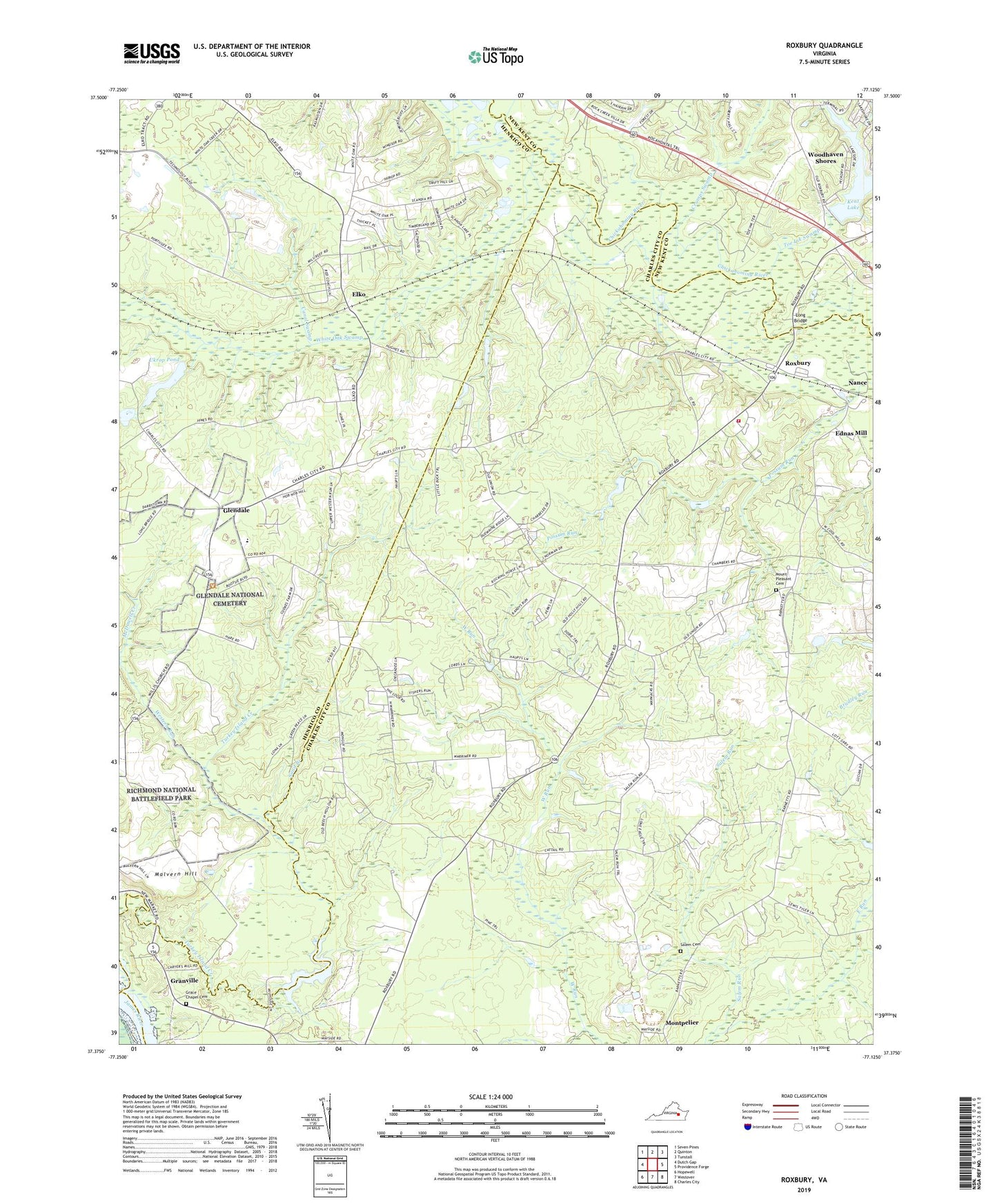
2019 topographic map quadrangle Roxbury in the state of Virginia. Scale: 1:24000. Based on the newly updated USGS 7.5' US Topo map series, this map is in the following counties: Charles City, Henrico, New Kent, Chesterfield. The map contains contour data, water features, and other items you are used to seeing on USGS maps, but also has updated roads and other features. This is the next generation of topographic maps. Printed on high-quality waterproof paper with UV fade-resistant inks.
Quads adjacent to this one:
West: Dutch Gap
Northwest: Seven Pines
North: Quinton
Northeast: Tunstall
East: Providence Forge
Southeast: Charles City
South: Westover
Southwest: Hopewell
Contains the following named places: Canal Swamp, Charles City Volunteer Fire Department Station 2, Chickahominy Academy, Chickahominy Tribal Center, Chickahominy Tribal Designated Statistical Area, Crumps Swamp, District 1, Ednas Mill, Elko, Glendale, Glendale National Cemetery, Grace Chapel Cemetery, Granville, Harrison Magisterial District, Hughes Store, James City County Sheriff's Office, Kent Dam, Long Bridge, Malvern Hill, McDowell Creek, Montpelier, Mount Pleasant Cemetery, Nance, Nances Shop, Roxbury, Saint Johns Church, Salem Cemetery, Salem Run, Samaria High School, Sand Branch, Shirley Mill Dam, Shirley Millpond, Toe Ink Swamp, Toe Ink Wayside, Turkey Island Creek, Ukrop Dam, Ukrop Pond, Union Church, Western Run, White Oak Swamp, Willis Church, Woodhaven Shores, Wrights Corner