MyTopo
Charles City Virginia US Topo Map
Couldn't load pickup availability
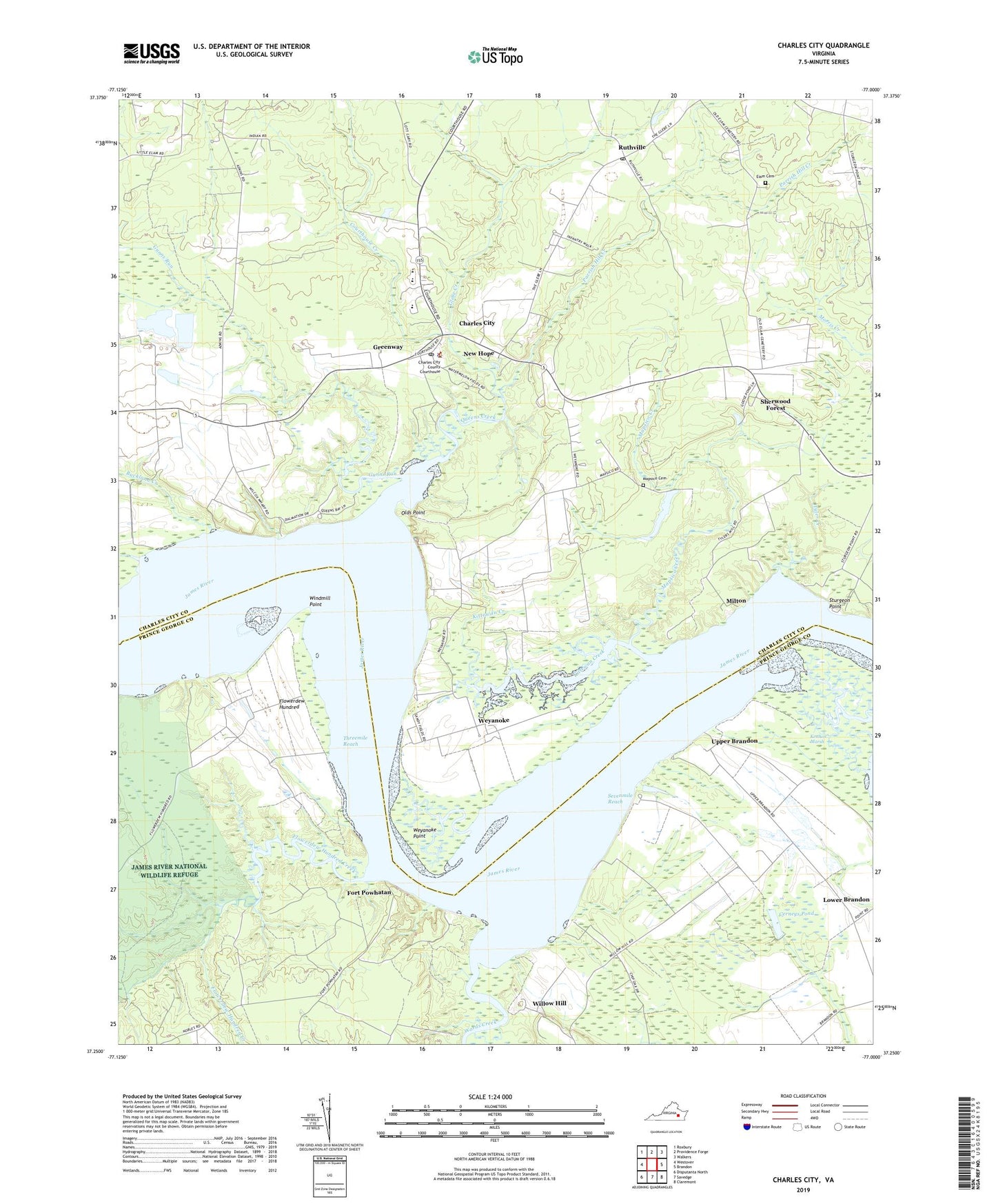
2022 topographic map quadrangle Charles City in the state of Virginia. Scale: 1:24000. Based on the newly updated USGS 7.5' US Topo map series, this map is in the following counties: Charles City, Prince George. The map contains contour data, water features, and other items you are used to seeing on USGS maps, but also has updated roads and other features. This is the next generation of topographic maps. Printed on high-quality waterproof paper with UV fade-resistant inks.
Quads adjacent to this one:
West: Westover
Northwest: Roxbury
North: Providence Forge
Northeast: Walkers
East: Brandon
Southeast: Claremont
South: Savedge
Southwest: Disputanta North
This map covers the same area as the classic USGS quad with code o37077c1.
Contains the following named places: Blanks Tavern, Bowens Store, Buckland Creek, Cerneys Dam, Cerneys Pond, Charles City, Charles City Census Designated Place, Charles City County, Charles City County Sheriff's Office, Charles City Elementary School, Charles City High School, Charles City Middle School, Charles City Post Office, Courthouse Creek, Dunnmore, Elam Baptist Church Cemetery, Elam Church, Flowerdew Hundred, Flowerdew Hundred Creek, Flowerdew Hundred Plantation, Fort Powhatan, Glebe Creek, Greenway, Gunns Run, Kennon Marsh, Kittewan Creek, Mapsico Cemetery, Mapsico Creek, Memorial United Methodist Church, Milton, Nelhassett Camp, New Hope, Olds Point, Parrish Hill Church, Parrish Hill Creek, Queens Creek, Ruffins Wharf, Ruthville, Ruthville Post Office, Sevenmile Reach, Sherwood Forest, Sturgeon Point, Threemile Reach, Tyler Creek, Tyler Magisterial District, Upper Brandon, Upper Brandon Farms Wharf, Wards Creek, Weyanoke, Weyanoke Point, Willcox Wharf, Willow Hill, Windmill Point, Wyanoke Neck, Wyanoke Wharf, ZIP Code: 23030