MyTopo
Smoky Ordinary Virginia US Topo Map
Couldn't load pickup availability
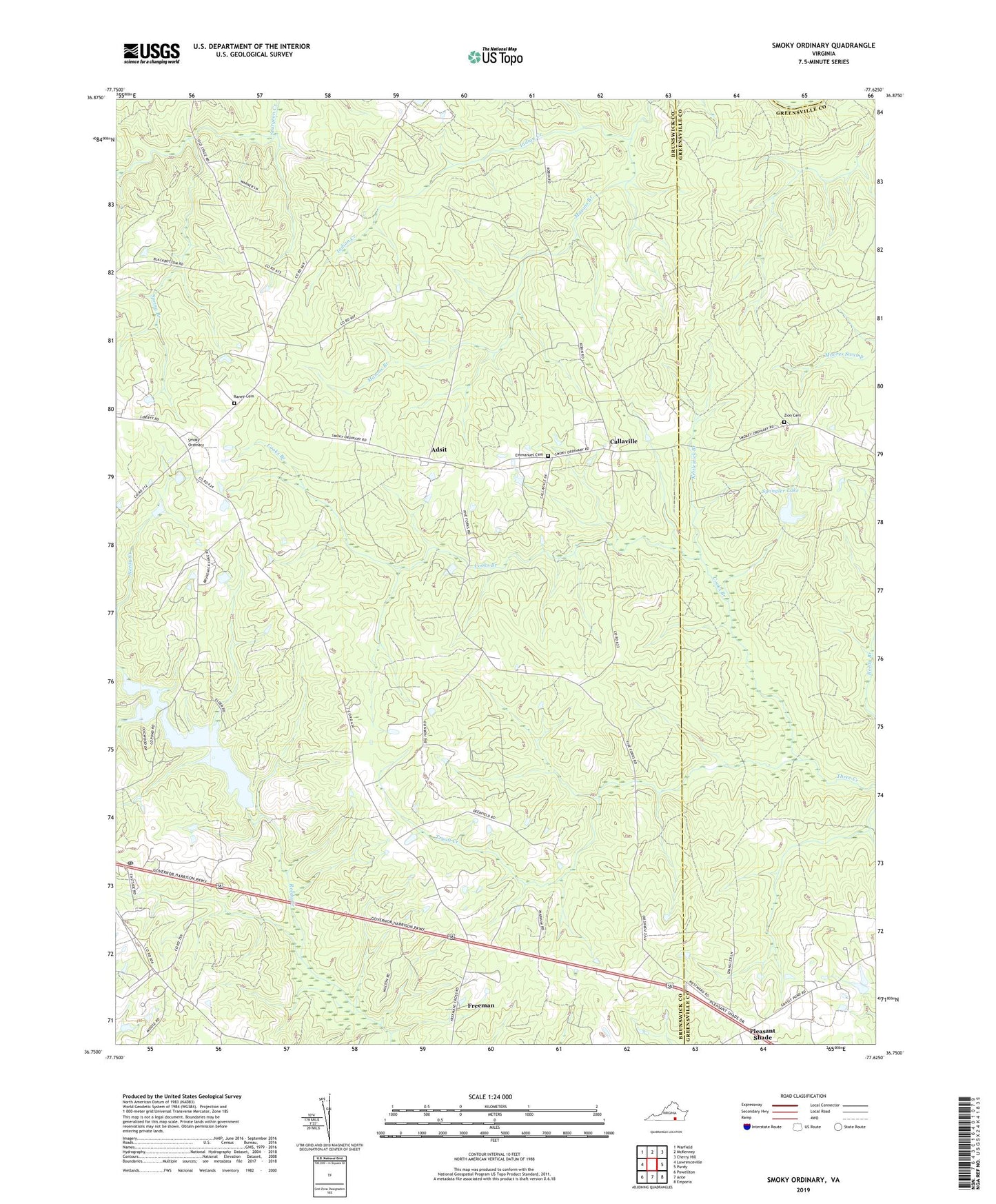
2019 topographic map quadrangle Smoky Ordinary in the state of Virginia. Scale: 1:24000. Based on the newly updated USGS 7.5' US Topo map series, this map is in the following counties: Brunswick, Greensville, Dinwiddie. The map contains contour data, water features, and other items you are used to seeing on USGS maps, but also has updated roads and other features. This is the next generation of topographic maps. Printed on high-quality waterproof paper with UV fade-resistant inks.
Quads adjacent to this one:
West: Lawrenceville
Northwest: Warfield
North: McKenney
Northeast: Cherry Hill
East: Purdy
Southeast: Emporia
South: Ante
Southwest: Powellton
Contains the following named places: Adsit, Brunswick County Dam, Brunswick County Lake, Brunswick County Pond, Callaville, Cooks Branch, Emmanuel Cemetery, Emmanuel Church, Freeman, Freeman Post Office, Kettlestick Branch, Mallory School, Masons Branch, Mount Calvary Church, Mount Carmel Church, Piney Grove Church, Pleasant Grove Church, Pleasant Shade, Pleasant Shade School, Poarch Store, Raney Cemetery, Reedy Creek Church, Smoky Ordinary, Spangler Dam, Spangler Lake, Spring Branch, Tryall Creek, Wilson Creek, Zion Cemetery, Zion Church, ZIP Code: 23856