MyTopo
Ante Virginia US Topo Map
Couldn't load pickup availability
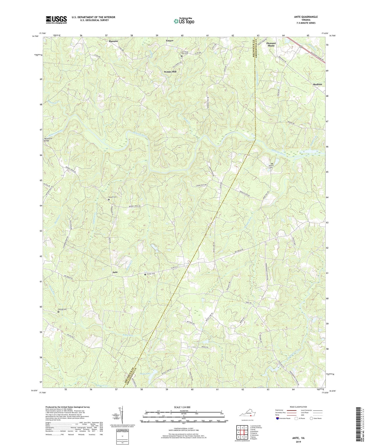
2022 topographic map quadrangle Ante in the state of Virginia. Scale: 1:24000. Based on the newly updated USGS 7.5' US Topo map series, this map is in the following counties: Brunswick, Greensville. The map contains contour data, water features, and other items you are used to seeing on USGS maps, but also has updated roads and other features. This is the next generation of topographic maps. Printed on high-quality waterproof paper with UV fade-resistant inks.
Quads adjacent to this one:
West: Powellton
Northwest: Lawrenceville
North: Smoky Ordinary
Northeast: Purdy
East: Emporia
Southeast: Skippers
South: Barley
Southwest: Valentines
This map covers the same area as the classic USGS quad with code o36077f6.
Contains the following named places: Ante, Bowen Cemetery, Brandy Creek, Cordle Cemetery, Douglas Run, Doyle Lake, Doyles Dam, Goose Berry Farm, Greensville Creek, Harris Crossroads, Hill Top Farm, Hobbs Chapel, Independence Church, Lightfoot Creek, Meadows Branch, Millpond Creek, Mitchells Dam, Mitchells Pond, Mount Vernon Church, New Hope Zion Cemetery, New Hope Zion Church, Pelhams Church, Phillips Cemetery, Powell Cemetery, Racume, Radium, Reedy Creek, Rising Star Church, Robinson Creek, Rocky Mount Church, Saint Thomas Church, Scott Lewis School, Totaro, Webbs Mill, Westward Bridge, White Oak Creek