MyTopo
Strasburg Virginia US Topo Map
Couldn't load pickup availability
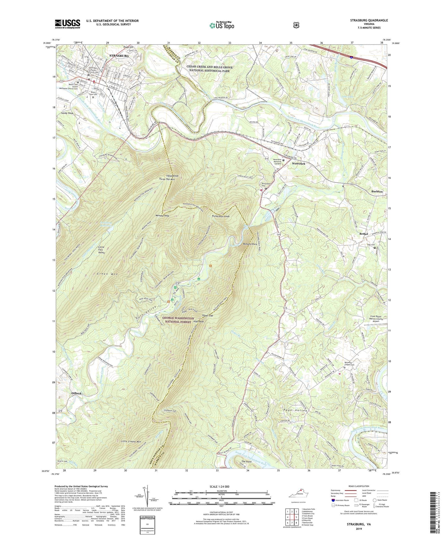
2019 topographic map quadrangle Strasburg in the state of Virginia. Scale: 1:24000. Based on the newly updated USGS 7.5' US Topo map series, this map is in the following counties: Warren, Shenandoah. The map contains contour data, water features, and other items you are used to seeing on USGS maps, but also has updated roads and other features. This is the next generation of topographic maps. Printed on high-quality waterproof paper with UV fade-resistant inks.
Quads adjacent to this one:
West: Toms Brook
Northwest: Mountain Falls
North: Middletown
Northeast: Stephens City
East: Front Royal
Southeast: Chester Gap
South: Bentonville
Southwest: Rileyville
Contains the following named places: Ashton Farm, Bear Wallow Trail, Bennett Chapel, Bennetts Chapel Cemetery, Bethel, Bethel Assembly of God Church, Bethel Church, Blue Hole, Bowmans Ford, Bowmans Mill, Buckton, Buckton Ford, Burkes Tree Farm, Buzzard Rock, Buzzard Rock Overlook, Cattle Ford, Cedar Creek, Cedar Spring Run, Deerpoint Campground, Dilbeck, District 6, Elizabeth Furnace, Elizabeth Furnace Recreational Area, Esbie Baptist Church, Fairhaven, Forest Grove, Fork District, Fort Valley, Fort Valley Overlook, Fortsmouth Volunteer Fire Department, Front Royal-Warren County Airport, Hall Cemetery, Heritage Baptist Church, High Peak, Hupp Hill, Hupp's Hill Historic Park, Lake John, Lake John Dam, Little Crease Mountain, Little Passage Creek, Little Passage Trail, Loch Linden Dam, Loch Linden Lake, Long Meadow, Mangens Farm, Meneka Peak, Molly Booth Run, Montvue Farms, Mount Zion Church, Mount Zion United Methodist Church Cemetery, Mountain View Farm, Otterburn School, Panorama Memorial Gardens, Passage Creek, Passage Creek for Trail, Richardson Cemetery, Richardson Knob, River Hill, River View Cemetery, Rivermont Volunteer Fire Department, Royal View Estates, Saint Paul Lutheran Church Cemetery, Saint Pauls Lutheran Church, Sandy Hook, Sandy Hook Elementary School, Shawl Gap, Shawl Gap Trail, Shenandoah County Fire and Rescue Station 25 - Strasburg Volunteer Rescue Squad, Shenandoah River Lakes, Shenandoah Valley Overlook, Signal Farm Retreat Center, Signal Knob, Signal Knob Middle School, Signal Knob Trail, Skyline Ranch Resort, Spanglers Mill, Stokes Branch, Strasburg, Strasburg Christian Church, Strasburg Dam, Strasburg Elementary School, Strasburg Fire Department Company 51, Strasburg High School, Strasburg Historic District, Strasburg Methodist Church, Strasburg Police Department, Strasburg Post Office, Strasburg Presbyterian Church, Strasburg Reservoir, The Church of Waterlick, The Mint House, The Point, Three Top Mountain, Town of Strasburg, Town Run, Virginia Fish Cultural Station, Wakeman Mill, Waterlick, Windcrest Farm