MyTopo
Willis Mountain Virginia US Topo Map
Couldn't load pickup availability
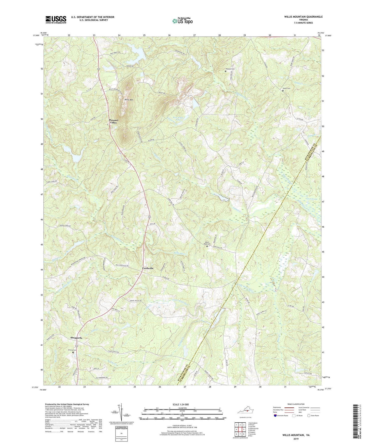
2019 topographic map quadrangle Willis Mountain in the state of Virginia. Scale: 1:24000. Based on the newly updated USGS 7.5' US Topo map series, this map is in the following counties: Buckingham, Cumberland. The map contains contour data, water features, and other items you are used to seeing on USGS maps, but also has updated roads and other features. This is the next generation of topographic maps. Printed on high-quality waterproof paper with UV fade-resistant inks.
Quads adjacent to this one:
West: Andersonville
Northwest: Buckingham
North: Dillwyn
Northeast: Gold Hill
East: Hillcrest
Southeast: Rice
South: Farmville
Southwest: Prospect
Contains the following named places: All Nations Church, Bishop Creek, Brier Creek, Cattail Creek, Curdsville, Dillwyn Church, District 2 Curdsville, Dobsons Bridge, East Ridge Pond, Fork Swamp, Gannaway School, Gills Creek, Holiness Church, Holy Trinity Church, Hubbard Cemetery, Kyanite Dam Number Three, Kyanite East Ridge Dam, Kyanite Mine Waste Dam Number One, Monroe Melvin and Johns Dam, Mount Nebo Cemetery, Mount Nebo Church, Nelson Fork, Oak Grove School, Perkins Creek, Pleasant Valley, Ridgeway Church, Salem Cemetery, Salem Church, Salem School, Saratoga School, Sheppards, Smyrna Cemetery, Smyrna Church, The Discovery School of Virginia, Tongue Quarter Creek, Whispering Creek, Willis Mountain, Willis River Number 5f Dam, Willis River Number Four Dam, Willis River Number Six Dam, Willis River Number Three Dam, Willis River Number Two Dam