MyTopo
Bodie Mountain Washington US Topo Map
Couldn't load pickup availability
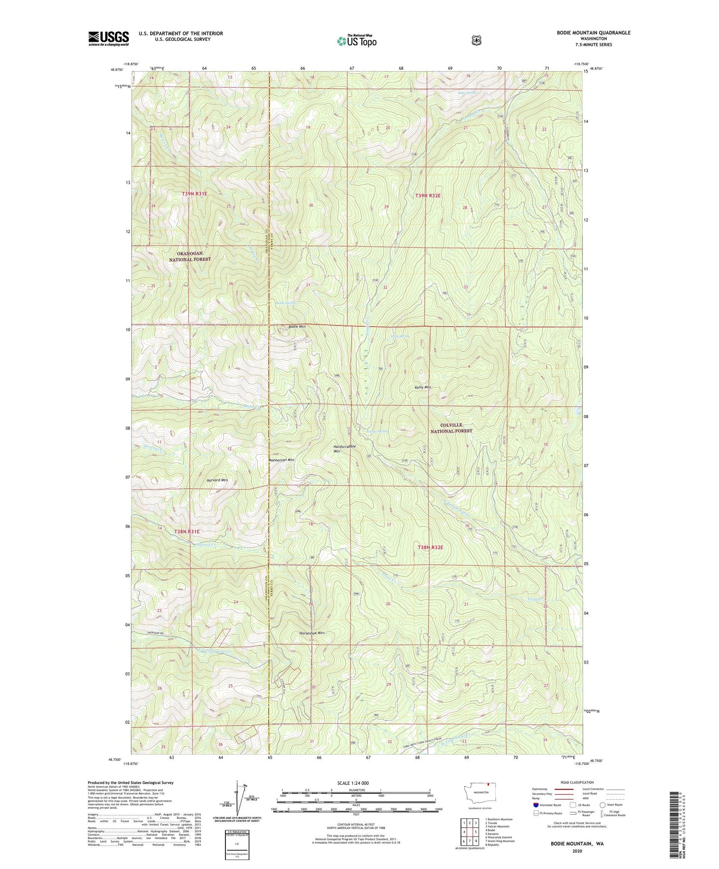
2020 topographic map quadrangle Bodie Mountain in the state of Washington. Scale: 1:24000. Based on the newly updated USGS 7.5' US Topo map series, this map is in the following counties: Ferry, Okanogan. The map contains contour data, water features, and other items you are used to seeing on USGS maps, but also has updated roads and other features. This is the next generation of topographic maps. Printed on high-quality waterproof paper with UV fade-resistant inks.
Quads adjacent to this one:
West: Bodie
Northwest: Buckhorn Mountain
North: Toroda
Northeast: Vulcan Mountain
East: Karamin
Southeast: Republic
South: Storm King Mountain
Southwest: Wauconda Summit
Contains the following named places: Bodie Mountain, Bodie Mountain Trail, Bodie Spring, Bodie Tonata Creek Trail, Cargo Spring, Cow Camp, Empire Drive Trail, Hardscrabble Mountain, Harvard Mountain, Horseshoe Mountain, Kelly Mine, Kelly Mountain, Kelly Spring, Laws Trail, Manhattan Mountain, North Fork Trout Creek, Old Sheridan Mine, Silver Bell Mine, State Spring