
MyTopo
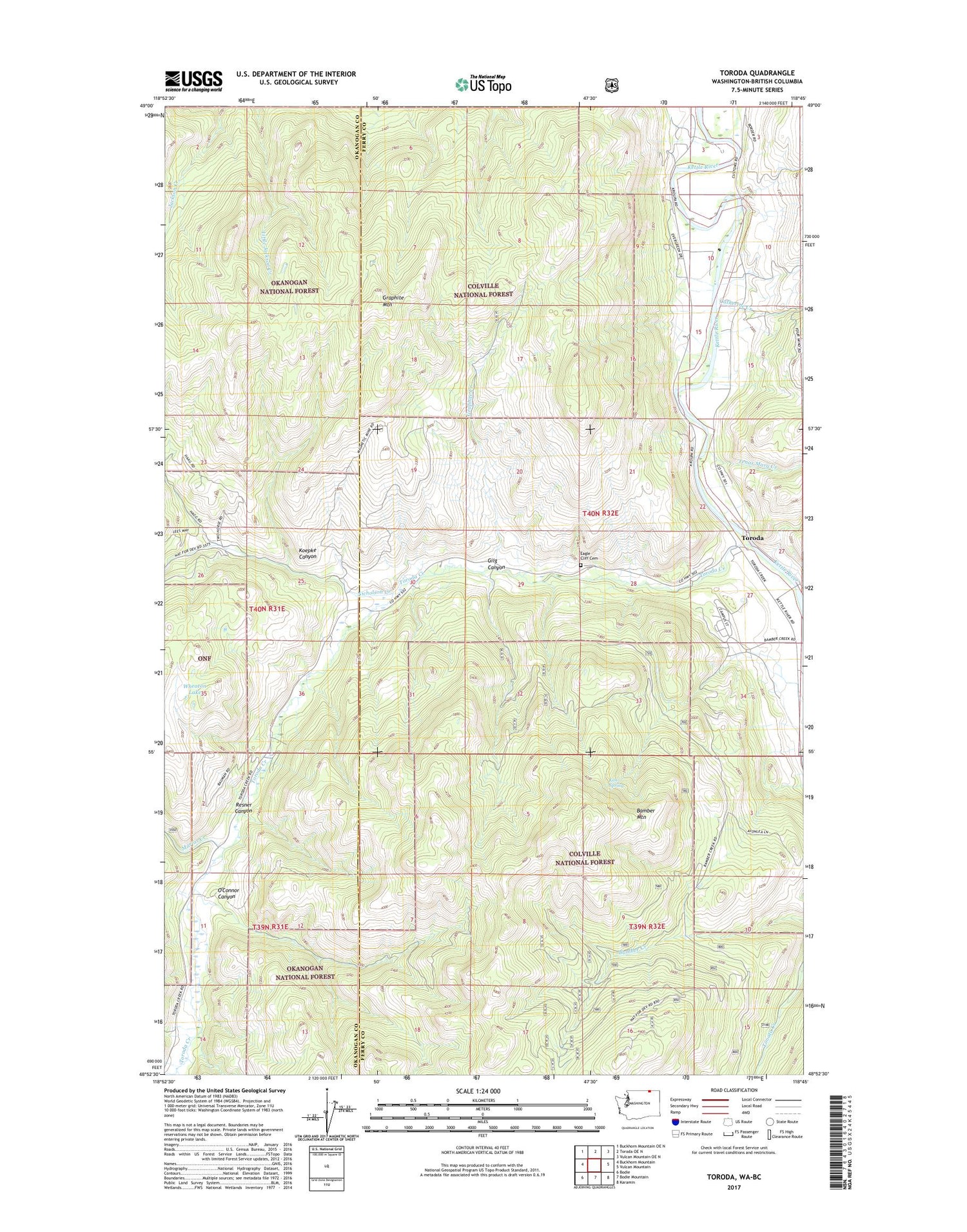
Toroda Washington US Topo Map
Couldn't load pickup availability
Also explore the Toroda Forest Service Topo of this same quad for updated USFS data
2023 topographic map quadrangle Toroda in the state of Washington. Scale: 1:24000. Based on the newly updated USGS 7.5' US Topo map series, this map is in the following counties: Ferry, Okanogan. The map contains contour data, water features, and other items you are used to seeing on USGS maps, but also has updated roads and other features. This is the next generation of topographic maps. Printed on high-quality waterproof paper with UV fade-resistant inks.
Quads adjacent to this one:
West: Buckhorn Mountain
Northwest: Buckhorn Mountain OE N
North: Toroda OE N
Northeast: Vulcan Mountain OE N
East: Vulcan Mountain
Southeast: Karamin
South: Bodie Mountain
Southwest: Bodie
This map covers the same area as the classic USGS quad with code o48118h7.
Contains the following named places: Bamber Mountain, Catherine Creek, Coogan Creek, Curlew Air Force Station, Curlew Civilian Conservation Center, Curlew Job Corps Wastewater Treatment Plant, Eagle Cliff Cemetery, Ferry, Ferry - Midway Port of Entry, Gilg Canyon, Graphite Creek, Graphite Mountain, Ken Spring, Koepke Canyon, Marias Creek, Nicholson Creek, North Ferry County Ambulance, O'Connor Canyon, Ranald MacDonald Historical Site, Resner Canyon, Tenas Mary Creek, Toroda, Toroda Creek, Wheaton Lake


