MyTopo
Bridgeport Washington US Topo Map
Couldn't load pickup availability
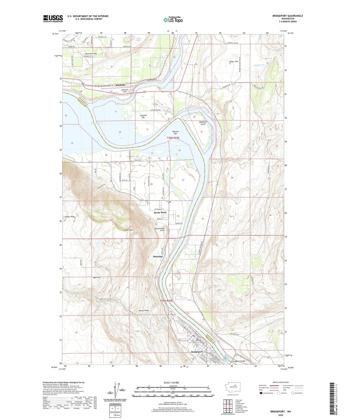
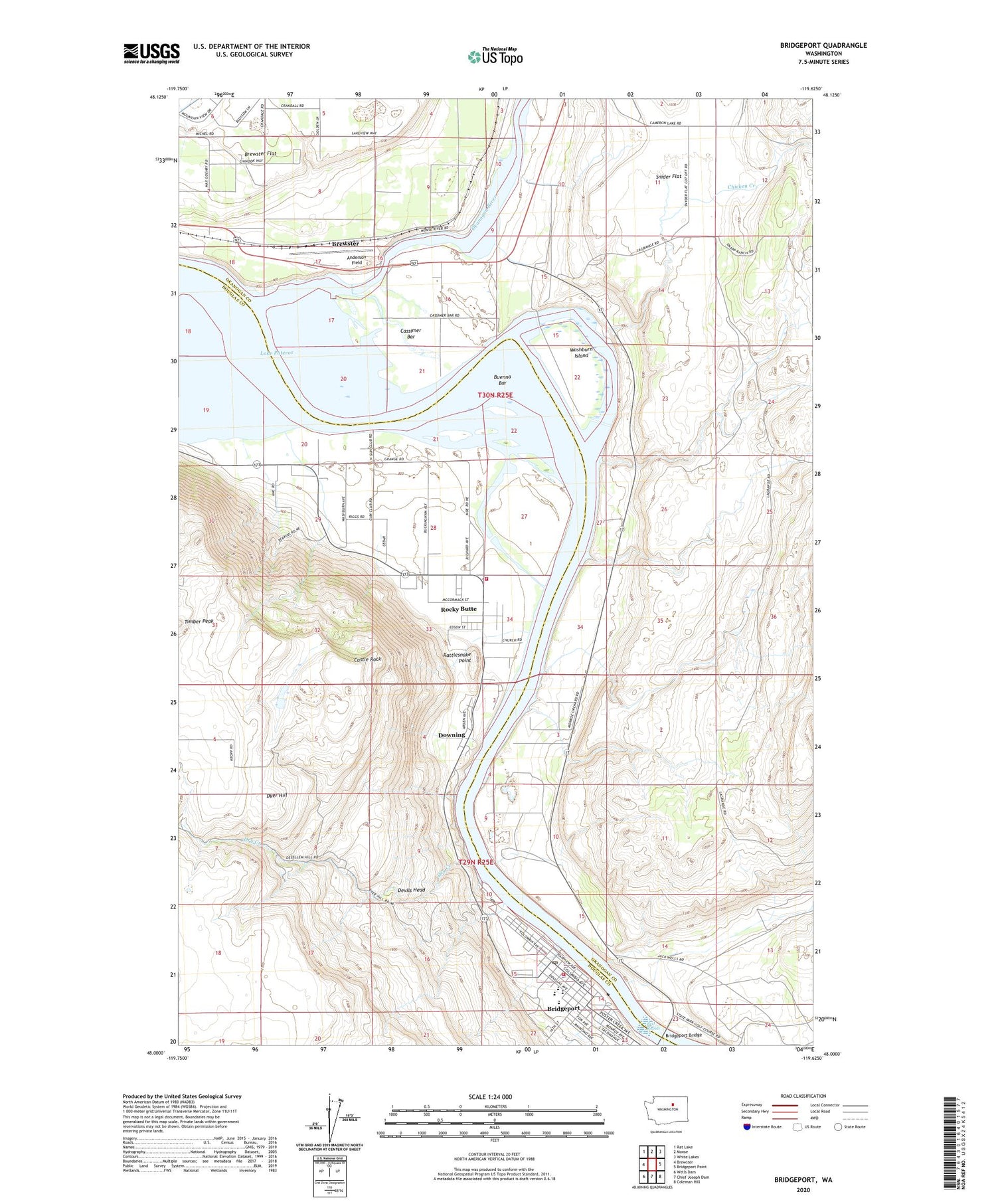
2020 topographic map quadrangle Bridgeport in the state of Washington. Scale: 1:24000. Based on the newly updated USGS 7.5' US Topo map series, this map is in the following counties: Okanogan, Douglas. The map contains contour data, water features, and other items you are used to seeing on USGS maps, but also has updated roads and other features. This is the next generation of topographic maps. Printed on high-quality waterproof paper with UV fade-resistant inks.
Quads adjacent to this one:
West: Brewster
Northwest: Rat Lake
North: Monse
Northeast: White Lakes
East: Bridgeport Point
Southeast: Coleman Hill
South: Chief Joseph Dam
Southwest: Wells Dam
Contains the following named places: Anderson Field, Bridgeport, Bridgeport Bar, Bridgeport Bar State Wildlife Recreation Area, Bridgeport Bridge, Bridgeport Elementary School, Bridgeport Grange, Bridgeport High School, Bridgeport Middle School, Bridgeport Park, Bridgeport Post Office, Bridgeport Volunteer Fire and Rescue, Buenna Bar, Cassimer Bar, Castle Rock, Chicken Creek, Chief Joseph, Chief Joseph State Park, City of Bridgeport, Devils Head, Douglas - Okanogan County Fire District 15 Rocky Butte Station 40, Douglas County Sheriff's Office, Downing, Dry Creek, Fort Okanogan, Fort Okanogan Overlook, Fort Okanogan State Park, Indian Cemetery, Kingdom Hall of Jehovahs Witnesses, Mountainview Pentecostal Church, Okanogan River, Old Port Columbia, Rattlesnake Point, Reef Rapids, Rock Ridge Park, Rocky Butte, Rocky Butte Church of the Nazarene, Snider Flat, Timber Peak, Washburn Island, Waterfront Park