MyTopo
Cedarville Washington US Topo Map
Couldn't load pickup availability
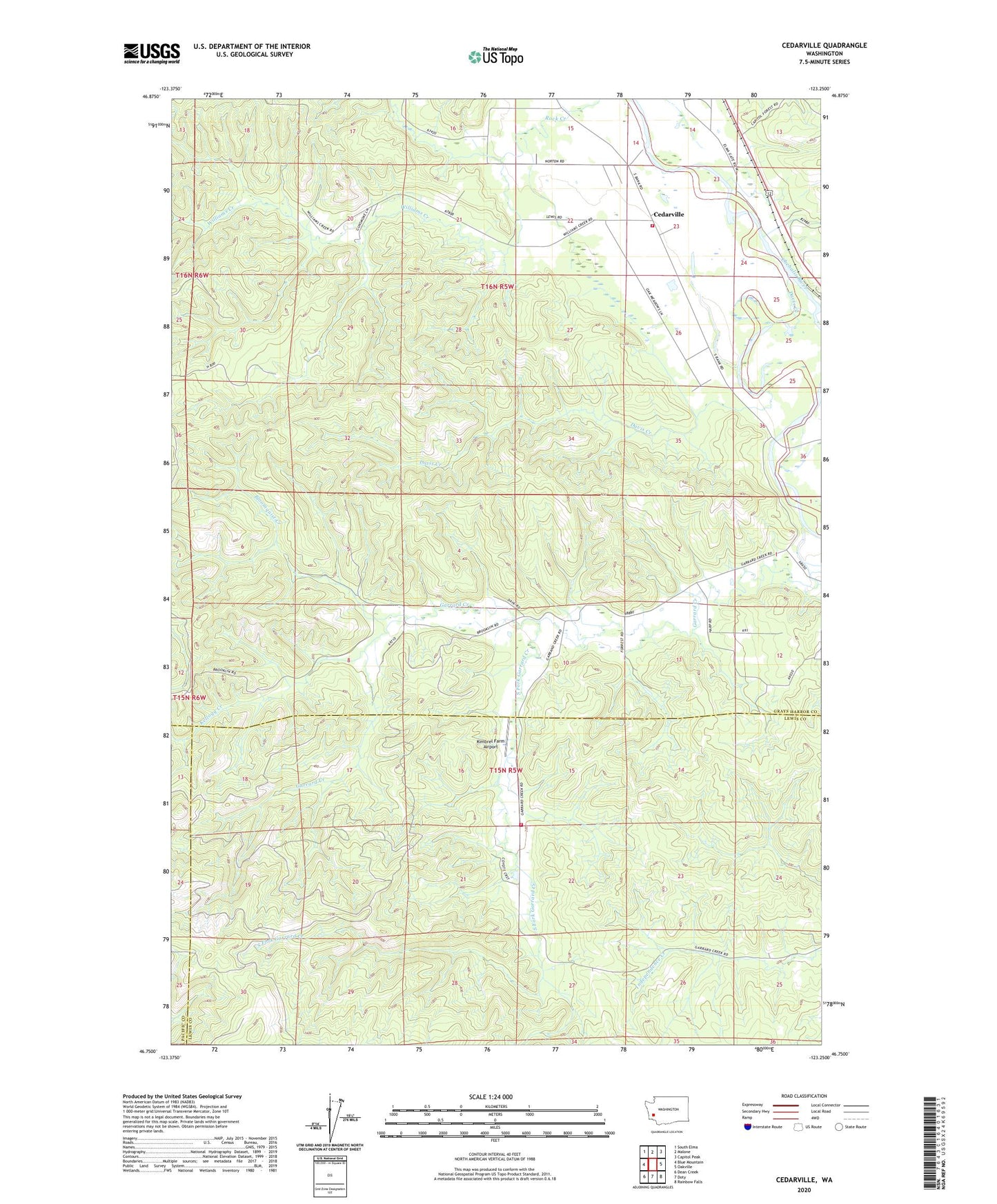
2020 topographic map quadrangle Cedarville in the state of Washington. Scale: 1:24000. Based on the newly updated USGS 7.5' US Topo map series, this map is in the following counties: Grays Harbor, Lewis, Pacific. The map contains contour data, water features, and other items you are used to seeing on USGS maps, but also has updated roads and other features. This is the next generation of topographic maps. Printed on high-quality waterproof paper with UV fade-resistant inks.
Quads adjacent to this one:
West: Blue Mountain
Northwest: South Elma
North: Malone
Northeast: Capitol Peak
East: Oakville
Southeast: Rainbow Falls
South: Doty
Southwest: Dean Creek
Contains the following named places: Bloomquist Creek, Callow, Cedarville, Cedarville Gravel Quarry, Cedarville Quarry, Davis Creek, Garrard Creek, Grays Harbor Fire District 1 Station 2, Kellogg Creek, Kimbrel Farm Airport, Lewis County Fire District 12 Riverside Fire Authority Station 8, Oakville Division, Reilly Dam, South Fork Garrard Creek, Williams Creek, ZIP Code: 98568