MyTopo
Oakville Washington US Topo Map
Couldn't load pickup availability
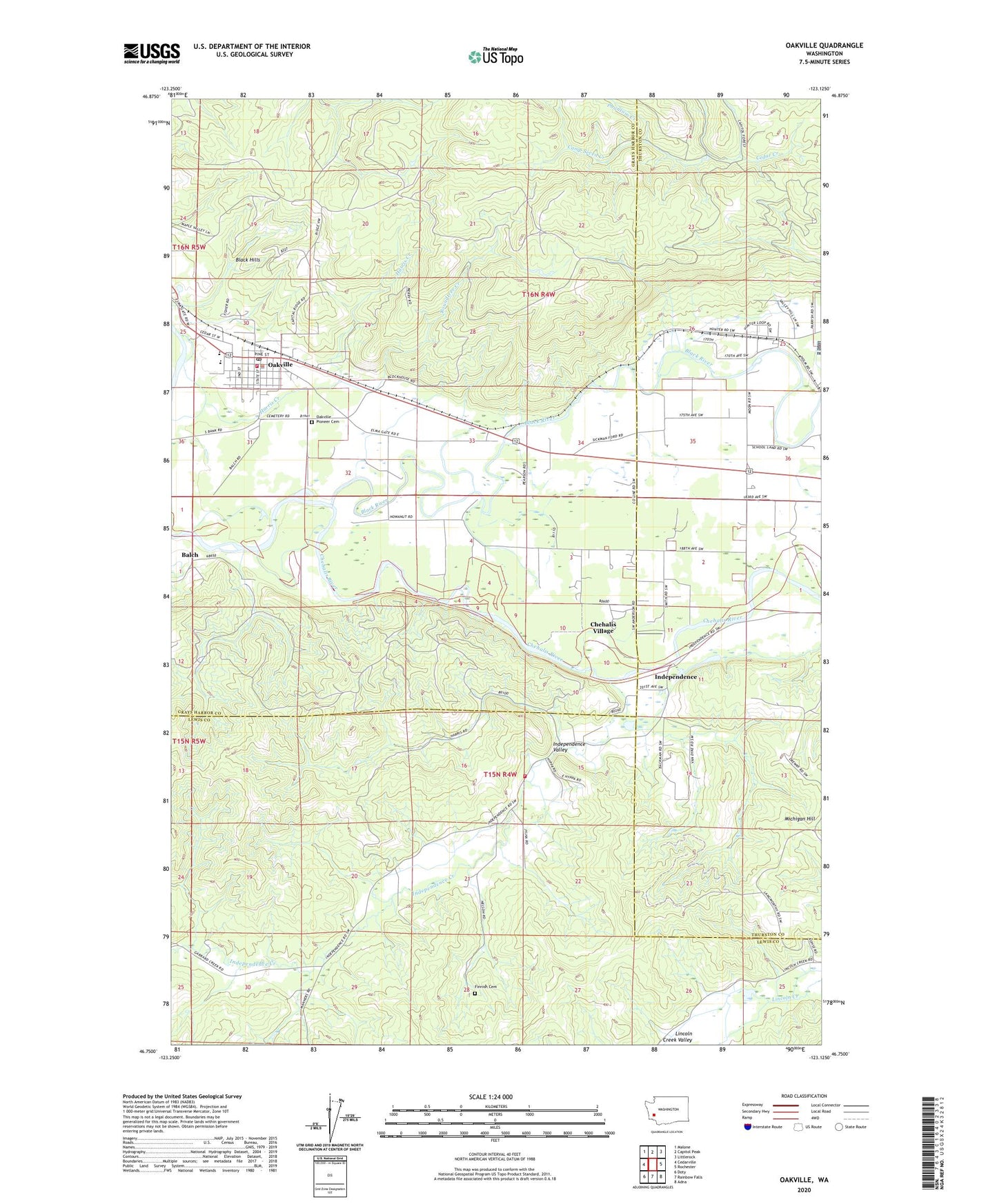
2023 topographic map quadrangle Oakville in the state of Washington. Scale: 1:24000. Based on the newly updated USGS 7.5' US Topo map series, this map is in the following counties: Grays Harbor, Lewis, Thurston. The map contains contour data, water features, and other items you are used to seeing on USGS maps, but also has updated roads and other features. This is the next generation of topographic maps. Printed on high-quality waterproof paper with UV fade-resistant inks.
Quads adjacent to this one:
West: Cedarville
Northwest: Malone
North: Capitol Peak
Northeast: Littlerock
East: Rochester
Southeast: Adna
South: Rainbow Falls
Southwest: Doty
This map covers the same area as the classic USGS quad with code o46123g2.
Contains the following named places: Balch, Black River, Camp Seven Creek, Capitol Ridge Quarry, Chehalis Reservation, Chehalis Village, Chehalis Village Census Designated Place, City of Oakville, Finnish Cemetery, Gate, Grays Harbor Fire District 1 Station 1, Harris Creek, Independence, Independence Creek, Independence Valley, Lewis County Fire District 12 Riverside Fire Authority Station 7, Lincoln Creek Grange, Oakville, Oakville Assembly of God Church, Oakville Elementary School, Oakville Middle - High School, Oakville Pioneer Cemetery, Oakville Police Department, Oakville Post Office, Oakville Quarry, Oakville School District Office, Oakville Timberland Library, Phantom Creek, Roundtree Creek, United Methodist Church of Oakville, ZIP Code: 98579