
MyTopo
Cliff Ridge Washington US Topo Map
Couldn't load pickup availability
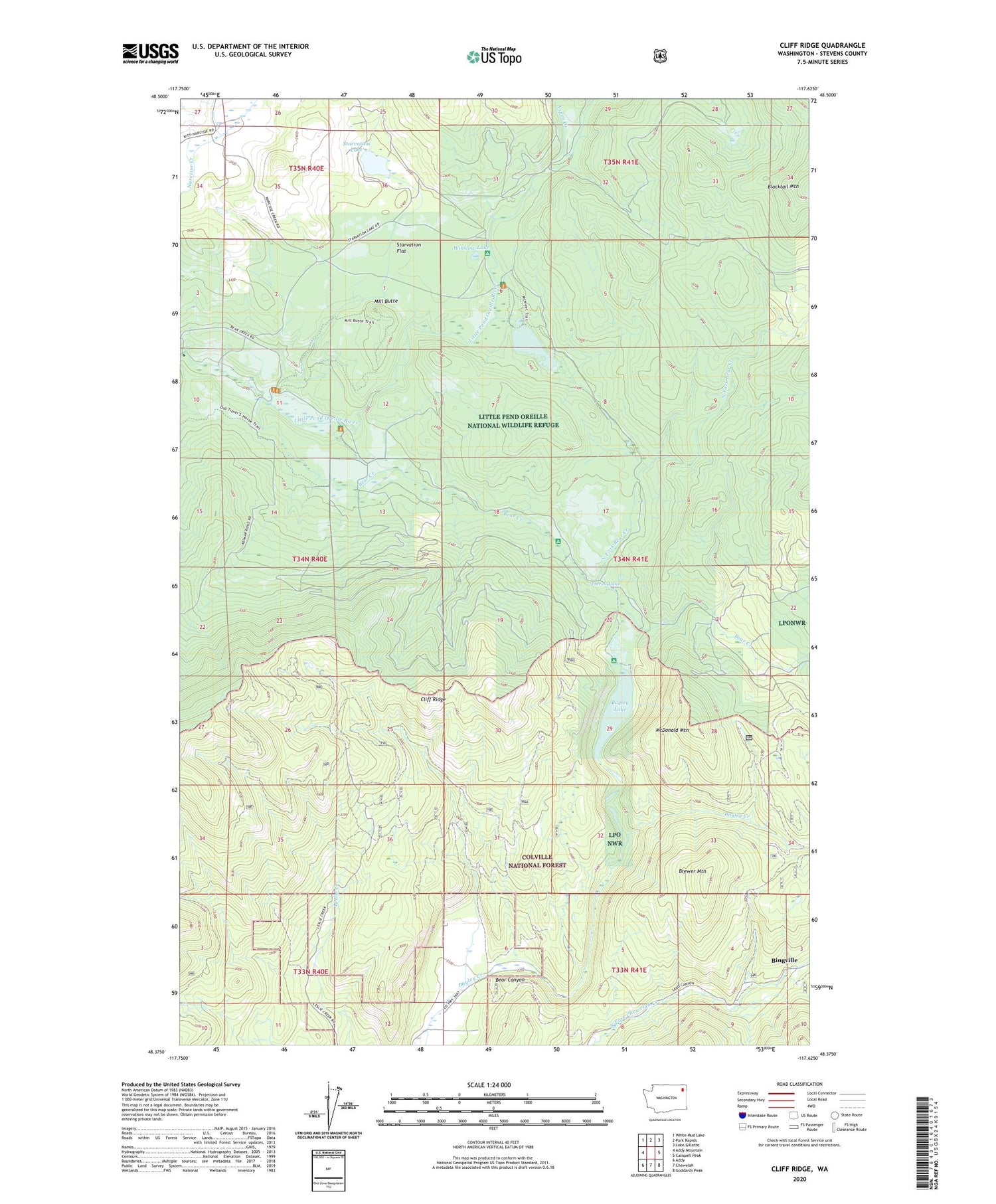
2020 topographic map quadrangle Cliff Ridge in the state of Washington. Scale: 1:24000. Based on the newly updated USGS 7.5' US Topo map series, this map is in the following counties: Stevens. The map contains contour data, water features, and other items you are used to seeing on USGS maps, but also has updated roads and other features. This is the next generation of topographic maps. Printed on high-quality waterproof paper with UV fade-resistant inks.
Quads adjacent to this one:
West: Addy Mountain
Northwest: White Mud Lake
North: Park Rapids
Northeast: Lake Gillette
East: Calispell Peak
Southeast: Goddards Peak
South: Chewelah
Southwest: Addy
Contains the following named places: Aspen Creek, Bayley Lake, Bear Canyon, Bear Creek, Bingville, Brewer Mountain, Camp Number One, Camp Number Two, Cliff Ridge, Little Pend Oreille National Wildlife Refuge, Little Pend Orielle State Wildlife Area, McDonald Mountain, McDowell Lake, McDowell Lake Dam, Mill Butte, Narcisse Grange, Narcisse School, North Fork Bear Creek, Perry Mine, Pierce Lake, Starvation Flat, Starvation Lake, Winslow Lake


