MyTopo
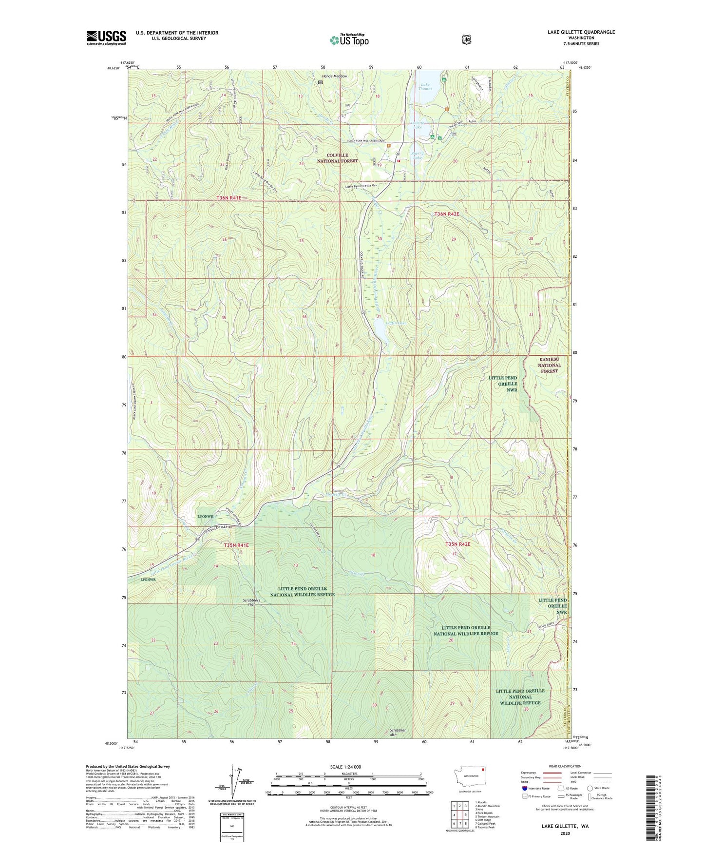
Lake Gillette Washington US Topo Map
Couldn't load pickup availability
Also explore the Lake Gillette Forest Service Topo of this same quad for updated USFS data
2023 topographic map quadrangle Lake Gillette in the state of Washington. Scale: 1:24000. Based on the newly updated USGS 7.5' US Topo map series, this map is in the following counties: Stevens, Pend Oreille. The map contains contour data, water features, and other items you are used to seeing on USGS maps, but also has updated roads and other features. This is the next generation of topographic maps. Printed on high-quality waterproof paper with UV fade-resistant inks.
Quads adjacent to this one:
West: Park Rapids
Northwest: Aladdin
North: Aladdin Mountain
Northeast: Ione
East: Timber Mountain
Southeast: Tacoma Peak
South: Calispell Peak
Southwest: Cliff Ridge
This map covers the same area as the classic USGS quad with code o48117e5.
Contains the following named places: Amazon Creek, Coffin Lake, Colville Air Force Station, Flodelle Campground, Flodelle Creek, Gap Creek, Gillette Creek, Gillette Lake, Gillette Recreation Area, Hande Creek, Hande Meadow, Hosmer Creek, Lake Thomas, Lake Thomas Campground, Little Pend Oreille Information Site, Middleport, Middleport Post Office, Olson Creek, Scrabblers Flat, Sherry Lake, Sherry Lake Dam, Spruce Canyon Youth Camp, Stevens County Fire District 9 - Little Pend Orielle Lakes