MyTopo
Eastsound Washington US Topo Map
Couldn't load pickup availability
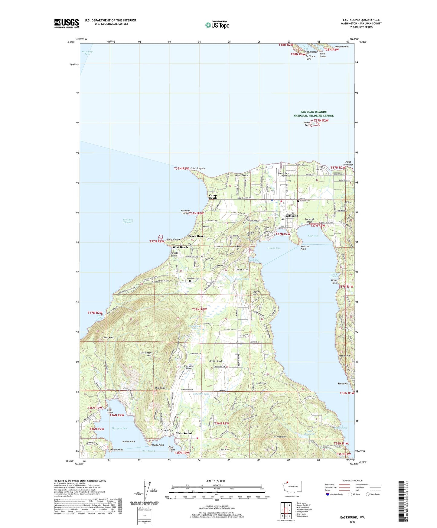
2020 topographic map quadrangle Eastsound in the state of Washington. Scale: 1:24000. Based on the newly updated USGS 7.5' US Topo map series, this map is in the following counties: San Juan. The map contains contour data, water features, and other items you are used to seeing on USGS maps, but also has updated roads and other features. This is the next generation of topographic maps. Printed on high-quality waterproof paper with UV fade-resistant inks.
Quads adjacent to this one:
West: Waldron Island
North: Sucia Island
Northeast: Lummi Bay OE W
East: Mount Constitution
Southeast: Blakely Island
South: Shaw Island
Southwest: Friday Harbor
Contains the following named places: Ayer Reservoir, Ayer Reservoir Dam, Beach Haven, Brandts Landing Eastsound Marina, Camp Orkila, Coon Hollow, Crescent Beach, Crow Valley, Crow Valley Airport, Dolphin, Dolphin Bay, Dolphin Bay Quarry, Double Hill, Eagle's Rock Christian Fellowship Church, East Sound, Eastsound, Eastsound Post Office, Elco Pit, Emmanuel Episcopal Church, Ev Henry Point, Fishing Bay, Fowler Pond, Fowler Reservoir Dam, Freeman Island, Freeman Island State Park, Giffin Rocks, Haida Point, Harbor Rock, Indian Point, Johnson Point, Judd Bay, Kimple Beach, Lookout Hill, Lovers Cove, Madrona Point, Massacre Bay, Mount Baker Cemetery, Mount Woolard, North Beach, Orcas Christian School, Orcas Division, Orcas Island, Orcas Island Airport, Orcas Island Community Church, Orcas Island Elementary School, Orcas Island Golf Course, Orcas Island High School, Orcas Island Historical Museum, Orcas Island Library, Orcas Island Middle School, Orcas Island Seventh Day Adventist Church, Orcas Island Transfer Station Solid Waste Facility, Orcas Island Yacht Club, Orcas Knob, Osprey Hill, Parker Reef, Picnic Island, Point Doughty, Point Kimple, Point Thompson, Rosario, Rosario Hill, Salmonberry School, San Juan County Fire District 2 / Orcas Island Fire and Rescue Station 21 Eastsound / Headquarters, San Juan County Fire District 2 / Orcas Island Fire and Rescue Station 22 Westsound, Schaefer Lake, Schaefer Lake Dam, Sea Island Shale Pit, Ship Bay, Ship Peak, Skull Island, Skull Island State Park, Skull Rock, Smith Dam, Snoring Bay, Terrill Beach, Tourtleback Lake, Tourtleback Lake Dam, Turtleback Mountain, West Beach, West Beach Resort Campground and Recreational Vehicle Park, West Sound, West Sound Marina, White Beach Bay, Wiggins Head, Woodlawn Cemetery