MyTopo
Foundation Ridge Washington US Topo Map
Couldn't load pickup availability
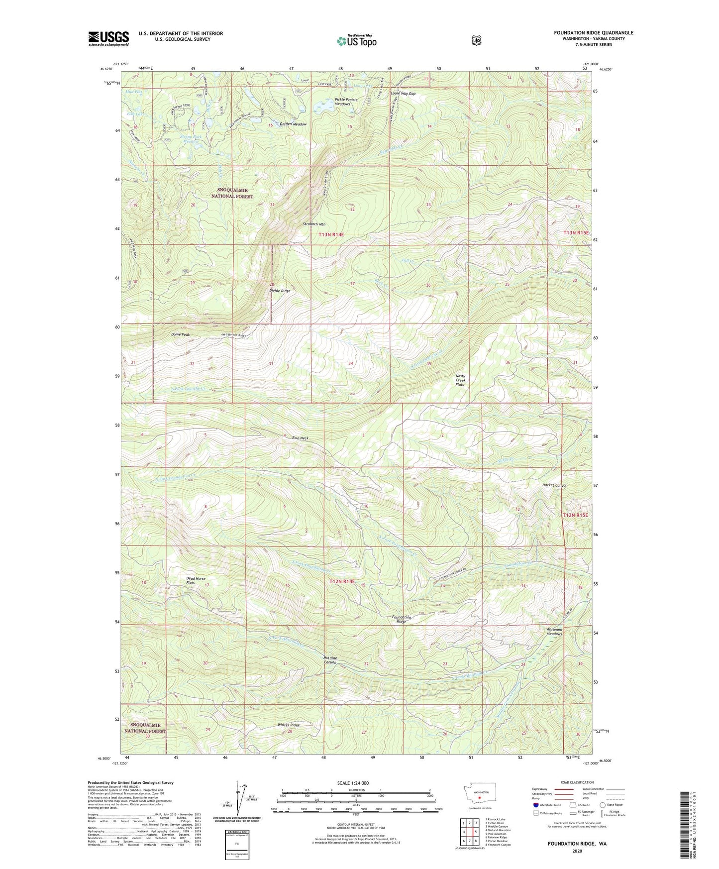
2020 topographic map quadrangle Foundation Ridge in the state of Washington. Scale: 1:24000. Based on the newly updated USGS 7.5' US Topo map series, this map is in the following counties: Yakima. The map contains contour data, water features, and other items you are used to seeing on USGS maps, but also has updated roads and other features. This is the next generation of topographic maps. Printed on high-quality waterproof paper with UV fade-resistant inks.
Quads adjacent to this one:
West: Darland Mountain
Northwest: Rimrock Lake
North: Tieton Basin
Northeast: Weddle Canyon
East: Pine Mountain
Southeast: Yesmowit Canyon
South: Piscoe Meadow
Southwest: Fairview Ridge
Contains the following named places: Ahtanum Guard Station, Ahtanum Meadow Campground, Ahtanum Meadows, Dead Horse Flats, Dome Peak, Ewe Neck, Fall Creek, Fish Lake, Foundation Ridge, Golden Meadow, Grey Rock Trail, Hacket Canyon, Long Lake, Louie Way Gap, McLaine Canyon, Middle Fork Ahtanum Creek, Mud Flat, Nasty Creek Flats, North Fork Foundation Creek, Pickle Prairie Meadows, Rock Creek, Sleepy Park Meadow, South Fork Foundation Creek, Strobach Mountain, ZIP Code: 98903