MyTopo
Gypsy Peak Washington US Topo Map
Couldn't load pickup availability
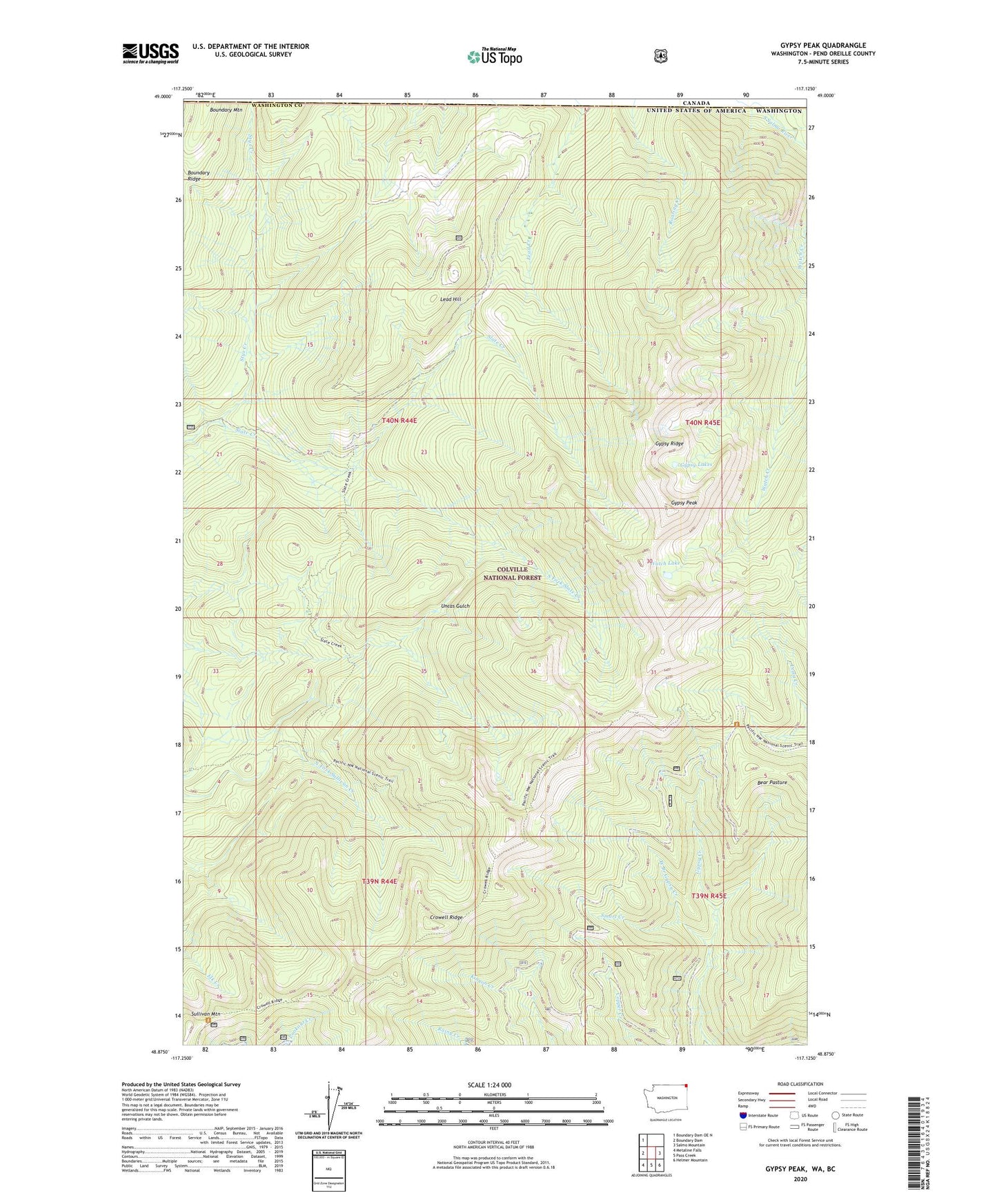
2020 topographic map quadrangle Gypsy Peak in the state of Washington. Scale: 1:24000. Based on the newly updated USGS 7.5' US Topo map series, this map is in the following counties: Pend Oreille. The map contains contour data, water features, and other items you are used to seeing on USGS maps, but also has updated roads and other features. This is the next generation of topographic maps. Printed on high-quality waterproof paper with UV fade-resistant inks.
Quads adjacent to this one:
West: Boundary Dam
Northwest: Boundary Dam OE N
East: Salmo Mountain
Southeast: Helmer Mountain
South: Pass Creek
Southwest: Metaline Falls
Contains the following named places: Bear Pasture, Boundary Mountain, Boundary Ridge, Crowell Ridge, Gypsy Lakes, Gypsy Peak, Gypsy Ridge, Lead Hill, Lead Hill Mine, Salmo-Priest Wilderness, Smart Creek, South Fork Slate Creek, State Creek Lookout, Styx Creek, Sullivan Mountain, Watch Lake, West Branch Gypsy Creek, ZIP Code: 99153