MyTopo
Kalama Washington US Topo Map
Couldn't load pickup availability
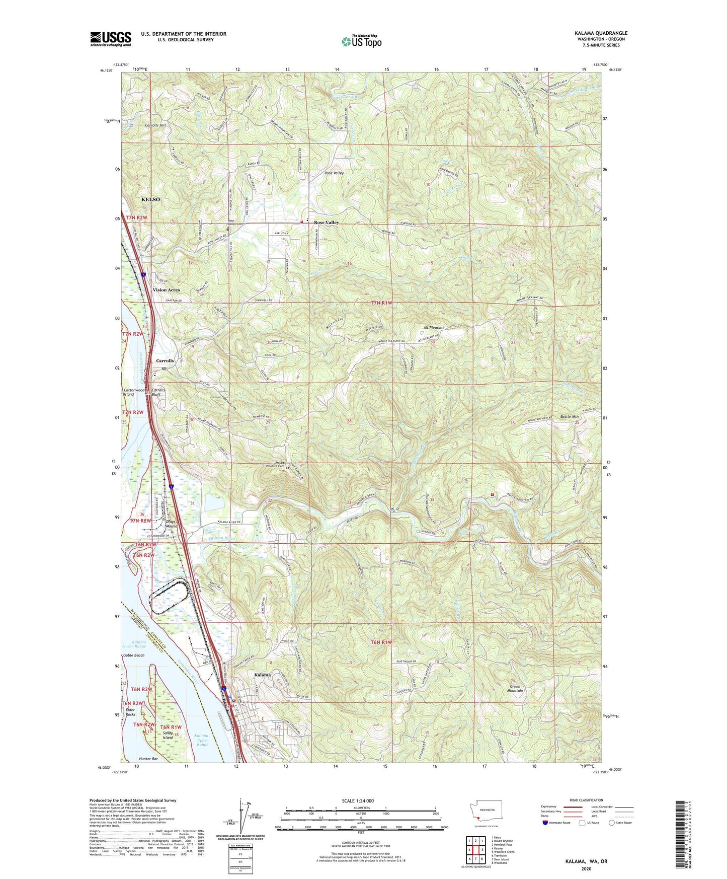
2020 topographic map quadrangle Kalama in the states of Washington, Oregon. Scale: 1:24000. Based on the newly updated USGS 7.5' US Topo map series, this map is in the following counties: Cowlitz, Columbia. The map contains contour data, water features, and other items you are used to seeing on USGS maps, but also has updated roads and other features. This is the next generation of topographic maps. Printed on high-quality waterproof paper with UV fade-resistant inks.
Quads adjacent to this one:
West: Rainier
Northwest: Kelso
North: Mount Brynion
Northeast: Hemlock Pass
East: Woolford Creek
Southeast: Woodland
South: Deer Island
Southwest: Trenholm
Contains the following named places: Battle Mountain, Carrolls, Carrolls Bluff, Carrolls Hill, Carrolls Post Office, Cedar Creek, City of Kalama, Cowlitz 2 Fire and Rescue Station 24 - Rose Valley, Cowlitz County Fire District 5 Station 51, Cowlitz County Fire District 5 Station 53, Davis Creek, Drays Mound, Elder Rocks, Goble Beach, Hatchery Creek, Hoffman Landing, Indian Creek, Kalama, Kalama Division, Kalama Lower Range, Kalama Police Department, Kalama Post Office, Kalama River, Marietta Creek, Marietta Falls, Mount Pleasant, Mount Pleasant Cemetery, North Fork Goble Creek, Nye Creek, Owl Creek, Port of Kalama Marina, Rose Valley, Rose Valley Cemetery, Rose Valley Elementary School, Sandy Island, Scipio's Goble Landing, Scipio's Goble Landing Boat Launch, Spencer Creek, Turner Creek, Vision Acres, Walters Arv Ultralight Airport