MyTopo
La Crosse West Washington US Topo Map
Couldn't load pickup availability
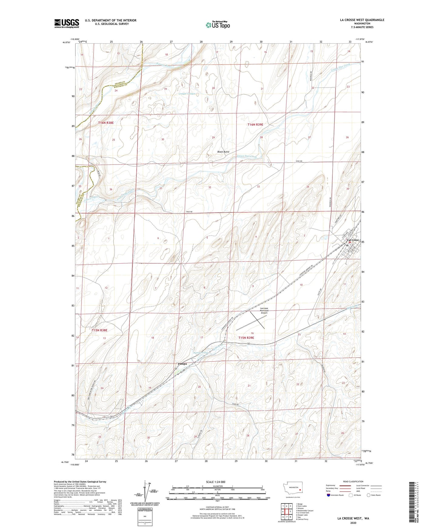
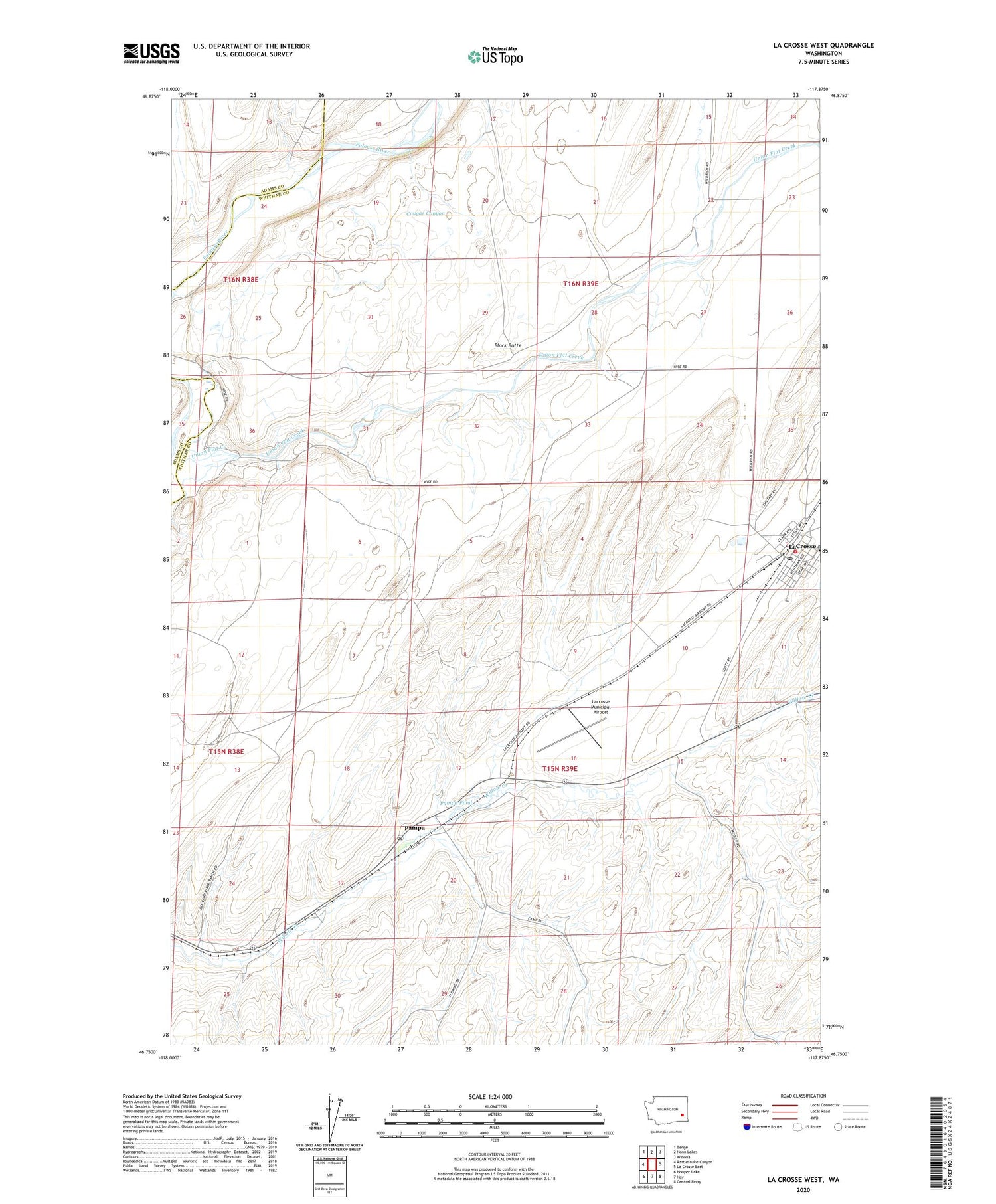
2020 topographic map quadrangle La Crosse West in the state of Washington. Scale: 1:24000. Based on the newly updated USGS 7.5' US Topo map series, this map is in the following counties: Whitman, Adams. The map contains contour data, water features, and other items you are used to seeing on USGS maps, but also has updated roads and other features. This is the next generation of topographic maps. Printed on high-quality waterproof paper with UV fade-resistant inks.
Quads adjacent to this one:
West: Rattlesnake Canyon
Northwest: Benge
North: Honn Lakes
Northeast: Winona
East: La Crosse East
Southeast: Central Ferry
South: Hay
Southwest: Hooper Lake
Contains the following named places: Black Butte, Cougar Canyon, La Crosse, Lacrosse City Fire Department, Lacrosse Municipal Airport, LaCrosse Post Office, Pampa, Pampa Pond, Robert Camp Memorial Track, Town of LaCrosse, Union Flat Creek