MyTopo
Hooper Lake Washington US Topo Map
Couldn't load pickup availability
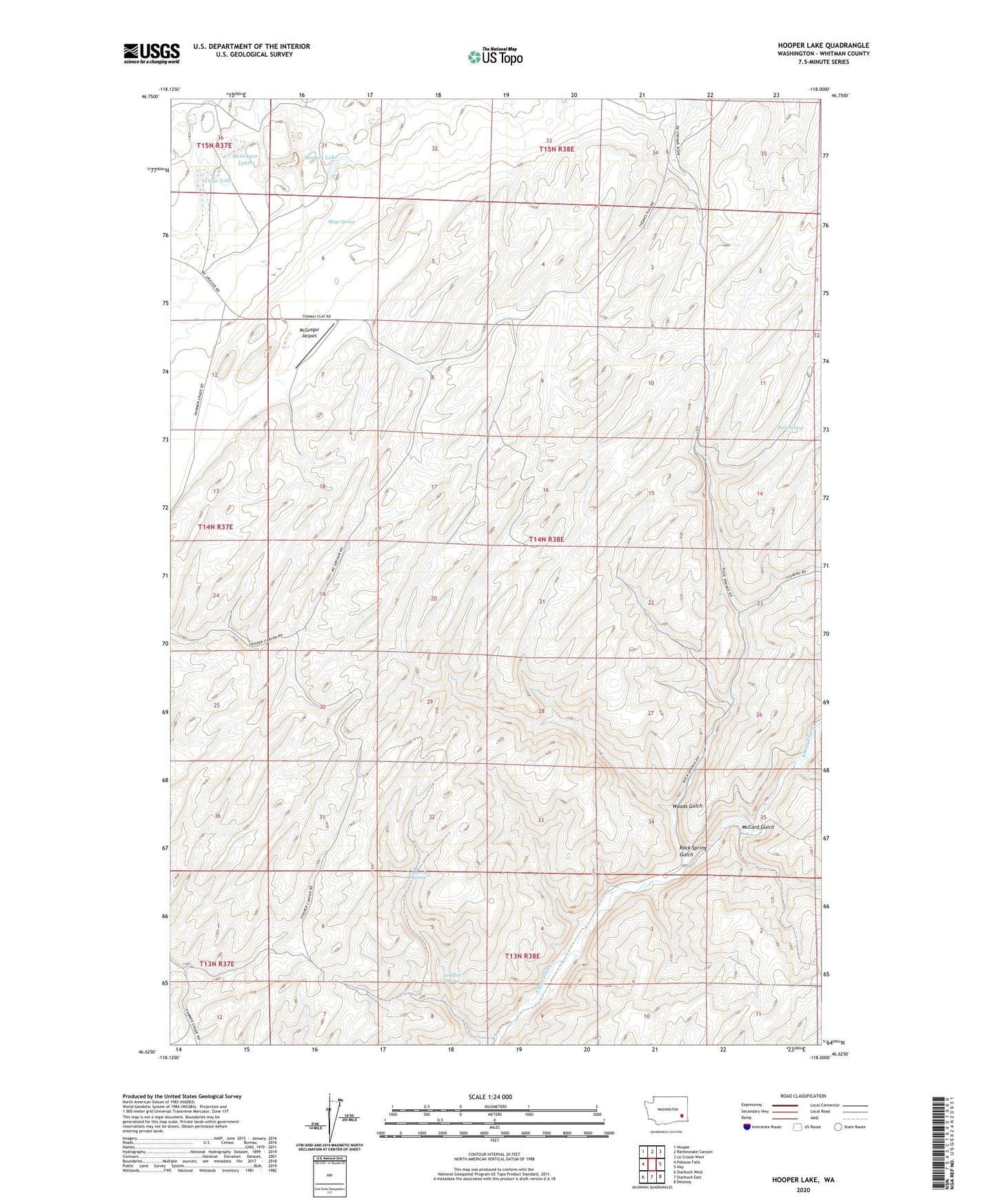
2023 topographic map quadrangle Hooper Lake in the state of Washington. Scale: 1:24000. Based on the newly updated USGS 7.5' US Topo map series, this map is in the following counties: Whitman. The map contains contour data, water features, and other items you are used to seeing on USGS maps, but also has updated roads and other features. This is the next generation of topographic maps. Printed on high-quality waterproof paper with UV fade-resistant inks.
Quads adjacent to this one:
West: Palouse Falls
Northwest: Hooper
North: Rattlesnake Canyon
Northeast: La Crosse West
East: Hay
Southeast: Delaney
South: Starbuck East
Southwest: Starbuck West
This map covers the same area as the classic USGS quad with code o46118f1.
Contains the following named places: Adarria Spring, Canyon, Clear Lake, Goldfish Spring, Gordon Farm, Hooper Lake, Mays Spring, McCard Gulch, McGregor Airport, McGregor Lakes, McGregor Ranch, Rock Spring, Rock Spring Gulch, Woods Gulch