MyTopo
Longbranch Washington US Topo Map
Couldn't load pickup availability
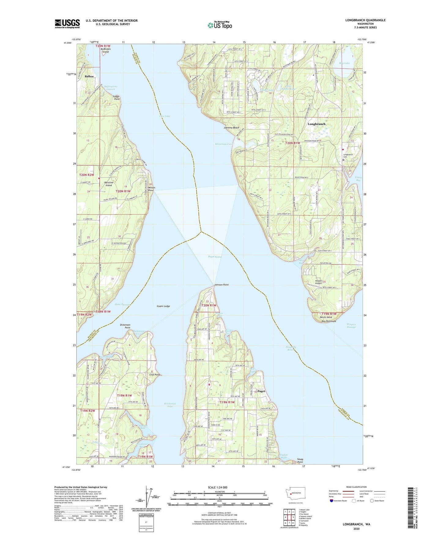
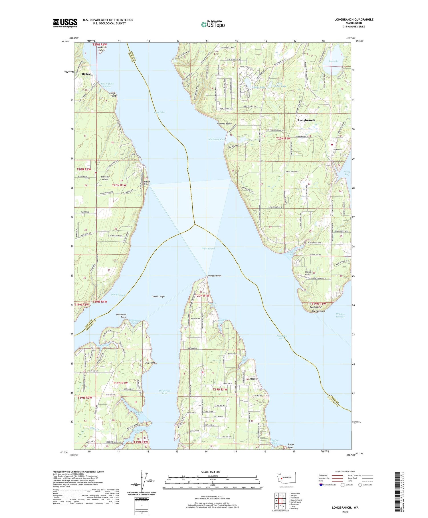
2020 topographic map quadrangle Longbranch in the state of Washington. Scale: 1:24000. Based on the newly updated USGS 7.5' US Topo map series, this map is in the following counties: Pierce, Thurston, Mason. The map contains contour data, water features, and other items you are used to seeing on USGS maps, but also has updated roads and other features. This is the next generation of topographic maps. Printed on high-quality waterproof paper with UV fade-resistant inks.
Quads adjacent to this one:
West: Squaxin Island
Northwest: Mason Lake
North: Vaughn
Northeast: Fox Island
East: McNeil Island
Southeast: Nisqually
South: Lacey
Southwest: Tumwater
Contains the following named places: Baird Cove, Ballow, Bay Lake, Big Fishtrap, Buffingtons Lagoon, Chapman Bay, Cliff Point, Dana Passage, Devils Head, Dickenson Cove, Dickenson Point, Dogfish Bight, Evergreen Elementary School, Fishtrap Heliport, Fudge Point, Greenfield Creek, Henderson Inlet, Howell Airport, Itsami Ledge, Joemma Beach, Johnson Point, KGHP-FM (Gig Harbor), Libby Creek, Little Palmer Lake, Longbranch, Longbranch Cemetery, Longbranch Census Designated Place, Longbranch Improvement Club Marina, Longbranch School, Mason County Fire District 5 Station 11 - South Harstine Island, McMicken Island, Mill Bight, Palmer Lake, Pierce County Fire Protection District 16 Key Peninsula Fire Department Station 4, Poncin Cove, Puget, South Bay Fire Department Station 8 - 2, Taylor Bay, Whiteman Cove, Whiteman Cove Dam, Wilson Point, Woodard Bay, ZIP Code: 98351