MyTopo
Mason Lake Washington US Topo Map
Couldn't load pickup availability
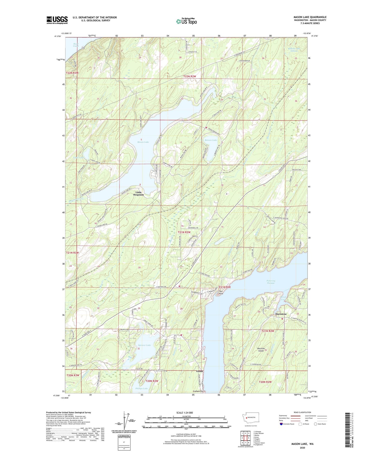
2023 topographic map quadrangle Mason Lake in the state of Washington. Scale: 1:24000. Based on the newly updated USGS 7.5' US Topo map series, this map is in the following counties: Mason. The map contains contour data, water features, and other items you are used to seeing on USGS maps, but also has updated roads and other features. This is the next generation of topographic maps. Printed on high-quality waterproof paper with UV fade-resistant inks.
Quads adjacent to this one:
West: Union
Northwest: Lilliwaup
North: Lake Wooten
Northeast: Belfair
East: Vaughn
Southeast: Longbranch
South: Squaxin Island
Southwest: Shelton
This map covers the same area as the classic USGS quad with code o47122c8.
Contains the following named places: Allyn, Benson Lake, Buck Lake Dam, Courner Dam, Graham Point, Grant, Grapeview School, Hartstene, Hiawata Creek, Hoke Creek, Jarrell Cove, Jarrell Cove State Park, Jarrell Creek, Jarrell's Cove Marina, Jones Creek, Little Hoquiam, Mason County Fire District 3 Station 2, Mason County Fire District 5 Station 3 Headquarters Mason - Benson, Mason County Fire District 5 Station 7 Pickering, Mason County Fire District 5 Station 9 - North Harstine Island, Mason Lake, Mason Lake Lookout, Phillips Lake, Pickering Passage, Schumacher Creek, Shady Beach, South Shore Division, Spencer Lake, Sun Point, Trask Lake, Twanoh State Park, Union-Grapeview Division, Walkers Landing, ZIP Code: 98546