MyTopo
Poisel Butte SE Washington US Topo Map
Couldn't load pickup availability
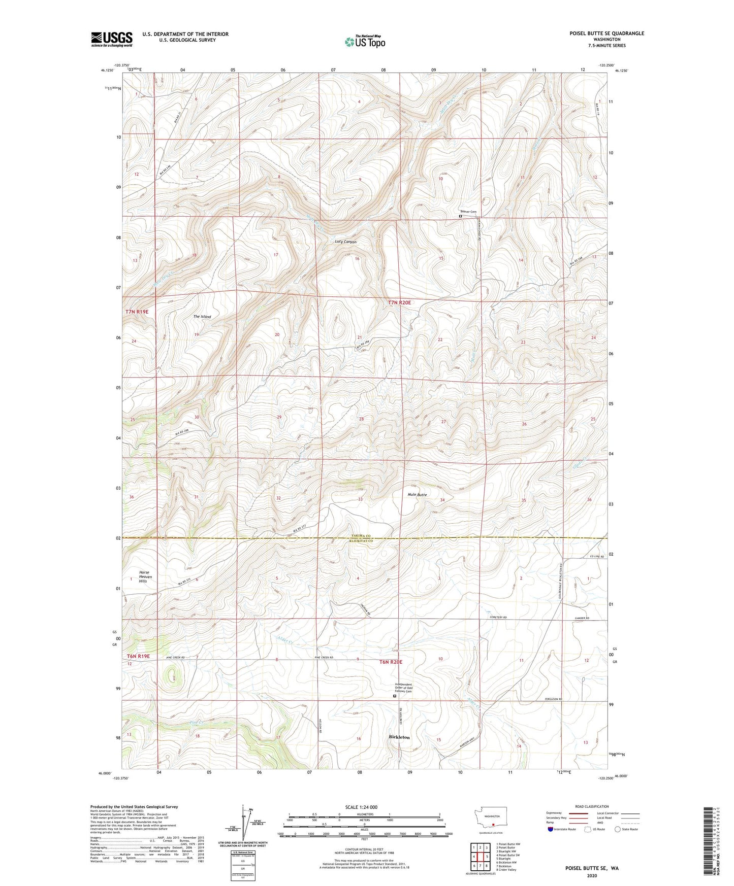
2020 topographic map quadrangle Poisel Butte SE in the state of Washington. Scale: 1:24000. Based on the newly updated USGS 7.5' US Topo map series, this map is in the following counties: Yakima, Klickitat. The map contains contour data, water features, and other items you are used to seeing on USGS maps, but also has updated roads and other features. This is the next generation of topographic maps. Printed on high-quality waterproof paper with UV fade-resistant inks.
Quads adjacent to this one:
West: Poisel Butte SW
Northwest: Poisel Butte NW
North: Poisel Butte
Northeast: Bluelight NW
East: Bluelight
Southeast: Crider Valley
South: Bickleton
Southwest: Bickleton NW
Contains the following named places: Beaver Cemetery, Bickleton Census Designated Place, Independent Order of Odd Fellows Cemetery, Lucy Canyon, Mule Butte, The Island, Wandlings Lower Camp