MyTopo
Roche Harbor Washington US Topo Map
Couldn't load pickup availability
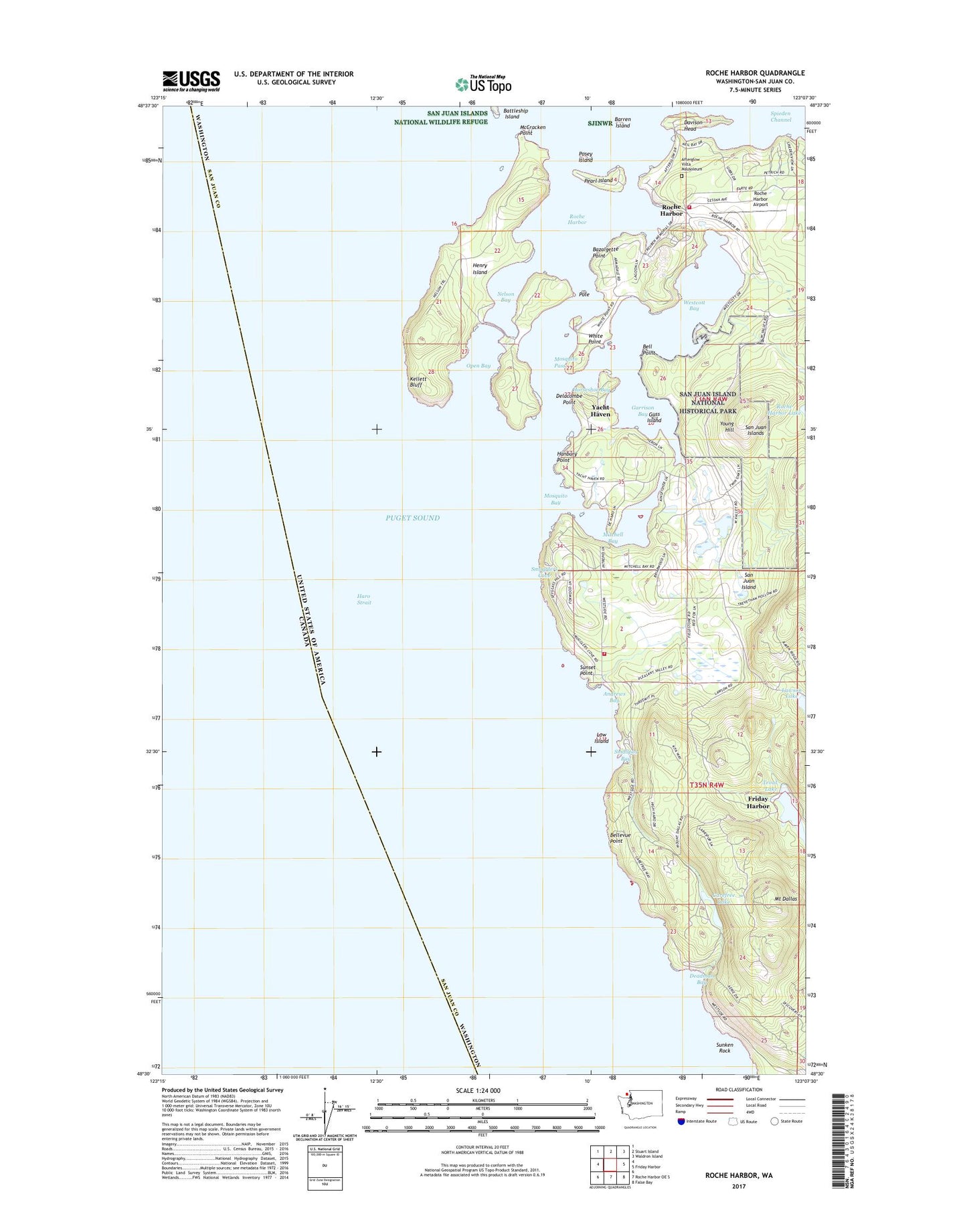
2020 topographic map quadrangle Roche Harbor in the state of Washington. Scale: 1:24000. Based on the newly updated USGS 7.5' US Topo map series, this map is in the following counties: San Juan. The map contains contour data, water features, and other items you are used to seeing on USGS maps, but also has updated roads and other features. This is the next generation of topographic maps. Printed on high-quality waterproof paper with UV fade-resistant inks.
Quads adjacent to this one:
North: Stuart Island
Northeast: Waldron Island
East: Friday Harbor
Southeast: False Bay
South: Roche Harbor OE S
Contains the following named places: Afterglow Vista Mausoleum and Cemetery, Andrews Bay, Barren Island, Battleship Island, Bazalgette Point, Bell Point, Bellevue Point, Carefree Lake, Davison Head, Deadman Bay, Delacombe Point, English Camp, English Camp Cemetery, Friday Harbor Watershed, Garrison Bay, Guss Island, Hanbury Point, Haro Strait, Henry Island, Horseshoe Bay, Kellett Bluff, Lawson Dam Number Two, Lime Kiln, Lime Kiln Lighthouse, Lime Kiln Point State Park, Low Island, McCracken Point, Mitchell Bay, Mosquito Bay, Mosquito Pass, Mount Dallas, Nelson Bay, Open Bay, Pearl Island, Pole, Posey Island, Posey Island State Park, Roache Habor Lake Dam, Roche Harbor, Roche Harbor Airport, Roche Harbor Census Designated Place, Roche Harbor Resort Marina, Roche Harbor Seaplane Base, Sams Dam, San Juan Island Fire Department Roche Harbor Station 35, San Juan Park, San Juan Park Campground, Seattle Yacht Club on Henry Island, Smallpox Bay, Smugglers Cove, Snug Harbor Marina Resort, Sunken Rock, Sunset Point, Trout Lake, Westcott Bay, White Point, Yacht Haven, Young Hill