MyTopo
Grantsville West Virginia US Topo Map
Couldn't load pickup availability
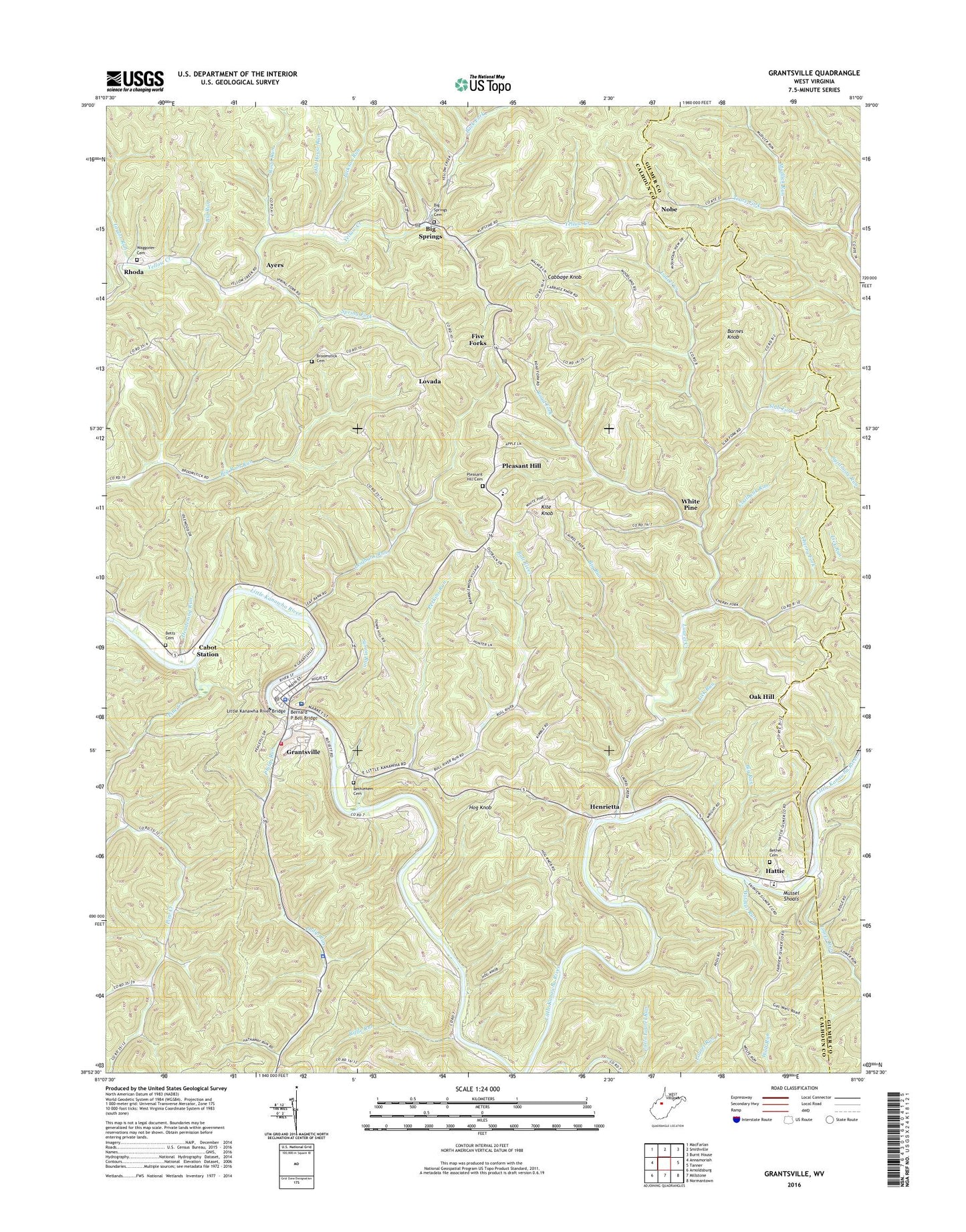
2019 topographic map quadrangle Grantsville in the state of West Virginia. Scale: 1:24000. Based on the newly updated USGS 7.5' US Topo map series, this map is in the following counties: Calhoun, Gilmer. The map contains contour data, water features, and other items you are used to seeing on USGS maps, but also has updated roads and other features. This is the next generation of topographic maps. Printed on high-quality waterproof paper with UV fade-resistant inks.
Quads adjacent to this one:
West: Annamoriah
Northwest: MacFarlan
North: Smithville
Northeast: Burnt House
East: Tanner
Southeast: Normantown
South: Millstone
Southwest: Arnoldsburg
Contains the following named places: Ayers, Back Fork, Barnes Knob, Bernard P Bell Bridge, Bethel Cemetery, Bethel Church, Bethlehem Baptist Church, Bethlehem Cemetery, Betts Cemetery, Big Fork, Big Run, Big Springs, Big Springs Cemetery, Big Springs Post Office, Broomstick Cemetery, Broomstick Church, Bull River, Cabbage Knob, Cabot Station, Calhoun - Gilmer Career Center, Calhoun County Courthouse, Calhoun County High School, Calhoun County Sheriff's Office, Calhoun General Hospital, Cherry Fork, Cherry Fork Church, Chestnut Grove Church, Coalbank Run, Deadening Run, District 3, Enon Church, Fairview Church, Fairview School, Five Forks, Five Forks Post Office, Grantsville, Grantsville Graded School, Grantsville Police Department, Grantsville Post Office, Grantsville Volunteer Fire Department, Hardman Chapel, Hattie, Henrietta, Hog Knob, Hog Knob School, Index, Jackson Run, Jackson School, Kite Knob, Klipstine School, Laurel Creek, Leafbank Run, Lick Run, Little Kanawha River Bridge, Lovada, Lower Run, Lower Run Church, Minnie Hamilton Health Care Center Emergency Medical Service, Minnie Hamilton Health System, Mudlick Run, Mussel Shoals, Nobe, Nobe Post Office, Oak Hill, Oak Hill School, Old House Run, Perkins Run, Philip Run, Philip Run Church, Philip Run School, Pine Creek, Pleasant Hill, Pleasant Hill Cemetery, Pleasant Hill Elementary School, Revere School, Rhoda, Riffle Run, Right Fork Pine Creek, Road Fork, Road Run, Simon Run, Slab Fork, Snider School, Spring Fork, Spruce Hollow School, Stevens School, Taylor Run, Town of Grantsville, Upper Pine Creek School, Waggoner Cemetery, West Virginia State Police Troop 4 - Grantsville Detachment, White Pine, Wildcat Run, ZIP Codes: 26137, 26147