MyTopo
Tanner West Virginia US Topo Map
Couldn't load pickup availability
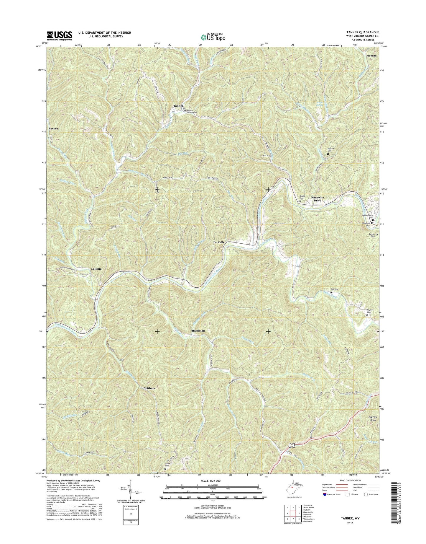
2023 topographic map quadrangle Tanner in the state of West Virginia. Scale: 1:24000. Based on the newly updated USGS 7.5' US Topo map series, this map is in the following counties: Gilmer. The map contains contour data, water features, and other items you are used to seeing on USGS maps, but also has updated roads and other features. This is the next generation of topographic maps. Printed on high-quality waterproof paper with UV fade-resistant inks.
Quads adjacent to this one:
West: Grantsville
Northwest: Smithville
North: Burnt House
Northeast: Auburn
East: Glenville
Southeast: Cedarville
South: Normantown
Southwest: Millstone
This map covers the same area as the classic USGS quad with code o38080h8.
Contains the following named places: Baptist Church Cemetery, Barbecue Run, Barton Cemetery, Bell Cemetery, Bell School, Big Pine Knob, Bird School, Bull Fork, Cedar Creek, Chestnut Grove Church, Crooked Run School, De Kalb, De Kalb School, Dry Run, Eliam Church, Fishpot Run, Grass Run, Hardman, Hardman Fork, Holbert Cemetery, Holt Run, Huffie Spring, Index, Job Run, Job Run School, Jobs Temple, Kanawha Drive, Keyster Cemetery, Latonia, Laurel Fork, Laurel Fork School, Leading Creek, Letter Gap, Letter Gap Post Office, Lick Run, Lower Big Run, Lucerne, Meadow Lane Cemetery, Middle Run, Millseat Run, Mount Pisgah Church, Paddy Run, Panther Run, Revore, Riddle Cemetery, Road Run, Rockcamp Run, Shiloh Church, Sinking Creek, Spring Fork, Sycamore Run, Tanner, Tanner Creek, Tanner Post Office, Third Run, Third Run School, Three Poplars Church, Trace Fork, Trace Fork Church, Turkeylick Run, Turner Cemetery, Upper Big Run, Walnut Grove School, Wesley Chapel, Withers, Wolfpen Run, Woodford Cemetery, Wyant Fork