MyTopo
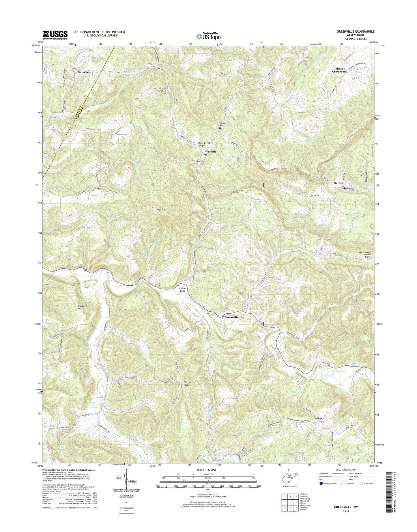
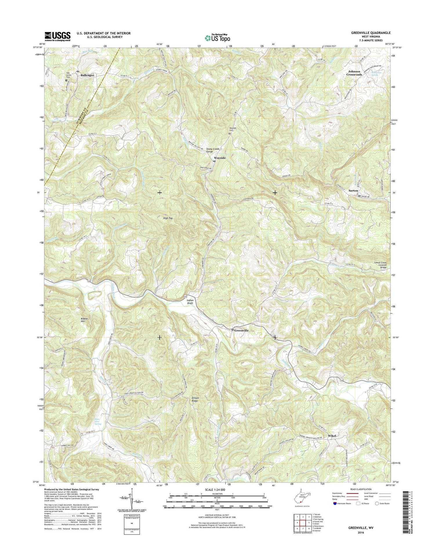
Greenville West Virginia US Topo Map
Couldn't load pickup availability
2019 topographic map quadrangle Greenville in the state of West Virginia. Scale: 1:24000. Based on the newly updated USGS 7.5' US Topo map series, this map is in the following counties: Monroe, Summers. The map contains contour data, water features, and other items you are used to seeing on USGS maps, but also has updated roads and other features. This is the next generation of topographic maps. Printed on high-quality waterproof paper with UV fade-resistant inks.
Quads adjacent to this one:
West: Forest Hill
Northwest: Talcott
North: Alderson
Northeast: Fort Spring
East: Union
Southeast: Interior
South: Lindside
Southwest: Peterstown
Contains the following named places: Ash Hill School, Back Creek, Ballengee, Ballengee Post Office, Buckeye School, Cooks Run, Cooks Run School, Davis School, Ellison Ridge, Fairview School, Greenville, Greenville Elementary School, Greenville Post Office, Hans Creek, Hans Creek Church, Hans Creek School, High Top, Hunter Springs School, Indian Creek Church, Indian Creek School, Indian Draft, Indian Draft School, Johnson Crossroads, Kibble Hill, Laurel Creek, Laurel Creek Covered Bridge, Lively School, Marvin Grove School, Milton Hall School, Mount Abraham School, Mount Alexander United Methodist Church, Mount Hermon Missionary Baptist Church, New Hope School, Oak Grove Cemetery, Oak Grove Methodist Church, Pleasant Grove School, Sarton, Sarton Post Office, Shady Grove School, Silas Gore Spring, Slate Run, Springfield Church, Springfield District, Symmes Branch, Upton Church, Upton School, Wayside, Wayside Cemetery, Wayside Church, Wayside Post Office, Wikel, Wikel Baptist Church, Woodrum Spring, ZIP Codes: 24918, 24945