MyTopo
Masontown West Virginia US Topo Map
Couldn't load pickup availability
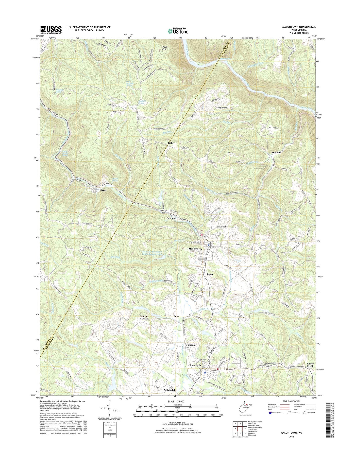
2019 topographic map quadrangle Masontown in the state of West Virginia. Scale: 1:24000. Based on the newly updated USGS 7.5' US Topo map series, this map is in the following counties: Preston, Monongalia. The map contains contour data, water features, and other items you are used to seeing on USGS maps, but also has updated roads and other features. This is the next generation of topographic maps. Printed on high-quality waterproof paper with UV fade-resistant inks.
Quads adjacent to this one:
West: Morgantown South
Northwest: Morgantown North
Northeast: Bruceton Mills
East: Valley Point
Southeast: Kingwood
South: Newburg
Southwest: Gladesville
Contains the following named places: Back Run, Beaverhole, Bee Run, Big Run, Bretz, Bretz Post Office, Bull Run, Burk, Cascade, Cheat View, Christopher Run, Dillan Creek, Dry Run, Elkins Coal and Coke Company Historic District, Falls Run, Frank Corbin Spring, Friendship School, Glady Run, Greer, Guseman, Kanes Creek, Kanes Creek United Methodist Church, Laurel Run, Lick Run, Lighthouse Cathedral, Maiden Spring, Masontown, Masontown Police Department, Masontown Post Office, Masontown Volunteer Fire Department and Rescue Company 6, Mayfield Spring, Middle Run, Morgan Mines, Mount Vernon, Mount Vernon United Methodist Church, Mountain Run, Ottie Mayfield Spring, Pikewood National Golf Club, Pleasant Valley United Methodist Church, Preston County Light and Power Company Dam, Preston County Light and Power Company Lake Number Two Dam, Reedsville, Reedsville Cemetery, Reedsville Police Department, Reedsville Post Office, Reedsville Volunteer Fire Department, Rohr, Sarver School, Scott Run, Slabcamp Run, Snake Hill Wildlife Management Area, Sturgiss Church, Sturgiss School, Sturgisson, Sturgisson United Methodist Church, Swamp Run, Town of Masontown, Town of Masontown Water Supply D Lake, Town of Masontown Water Supply Dam, Town of Reedsville, Upper Deckers Creek Structure Four Dam, Upper Deckers Creek Structure Number Five Dam, Upper Deckers Creek Structure Number One Dam, Upper Deckers Creek Structure Number Seven Dam, Upper Deckers Creek Structure Number Three Dam, Upper Deckers Creek Structure Number Two Dam, Upper Deckers Creek Wildlife Management Area, Valley District, Valley District Ambulance Service, West Preston Middle School, Zina Chapel, Zinn Chapel, Zion Church, ZIP Codes: 26542, 26547