MyTopo
Newburg West Virginia US Topo Map
Couldn't load pickup availability
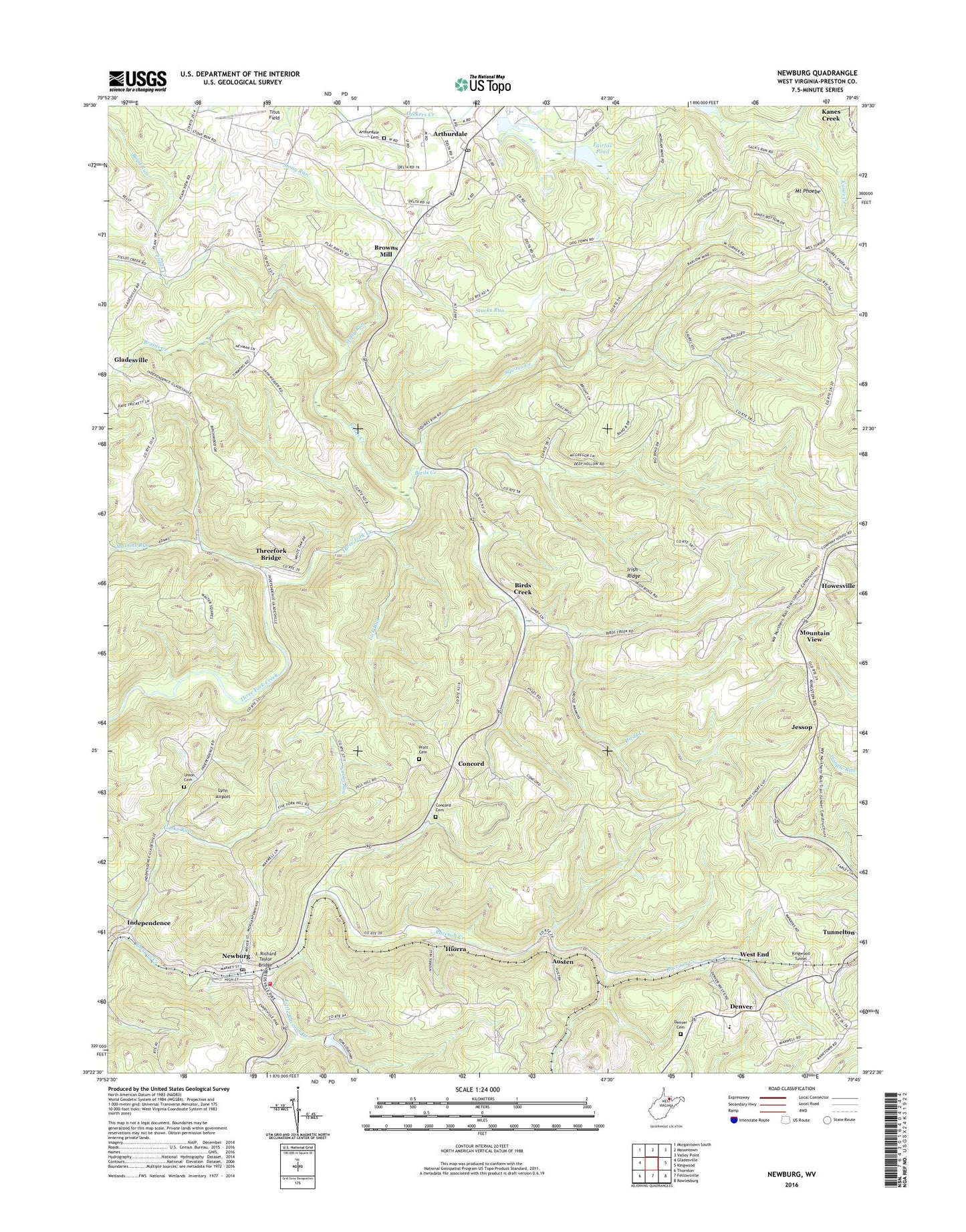
2023 topographic map quadrangle Newburg in the state of West Virginia. Scale: 1:24000. Based on the newly updated USGS 7.5' US Topo map series, this map is in the following counties: Preston. The map contains contour data, water features, and other items you are used to seeing on USGS maps, but also has updated roads and other features. This is the next generation of topographic maps. Printed on high-quality waterproof paper with UV fade-resistant inks.
Quads adjacent to this one:
West: Gladesville
Northwest: Morgantown South
North: Masontown
Northeast: Valley Point
East: Kingwood
Southeast: Rowlesburg
South: Fellowsville
Southwest: Thornton
This map covers the same area as the classic USGS quad with code o39079d7.
Contains the following named places: Alder School, Arthurdale, Arthurdale Cemetery, Arthurdale Census Designated Place, Arthurdale Historic District, Arthurdale Post Office, Arthurdale School, Austen, B O Dam on Little Raccoon Creek, Bethlehem United Methodist Church, Birds Creek, Birds Creek United Methodist Church, Boyd Run, Brains Creek, Browns Mill, Chestnut Ridge, Chestnut Ridge School, Chestnut Ridge United Brethren Church, Chestnut Ridge United Methodist Church, Community Presbyterian Church, Concord, Concord Cemetery, Concord School, Cooks Run, Denver, Denver Cemetery, Denver Elementary School, Denver United Methodist Church, Fairfax Pond, Fairfax Pond Dam, Fields Creek, Gordon Church, Gordon School, Harmony School, Hiorra, Hopewell Church, Howesville, Howesville Church of Christ, Howesville United Methodist Church, Independence, Independence Post Office, Ingleside School, Irish Ridge, Irish Ridge School, J. Richard Taylor Bridge, Jessop, Kingwood Tunnel, Lick Run, Little Raccoon Creek, Lynn Airport, Mankin School, Martins Run, Mount Phoebe, Mountain View, New Deal Homestead Museum, Newburg, Newburg Elementary School, Newburg Post Office, Newburg Volunteer Fire Department, Oriole, Pell School, Pratt Cemetery, Saint Josephs School, Slabtown Schoolhouse, Squires Creek, Stacks Run, Stony Run, Third District, Threefork Bridge, Titus Field, Town of Newburg, Towson, Triune School, Tunnelton Denver Elementary School, Union Cemetery, Upper Deckers Creek Structure Number Six Dam, Valley Elementary School, West End, West End United Brethren Church, ZIP Codes: 26410, 26520