MyTopo
Oxford West Virginia US Topo Map
Couldn't load pickup availability
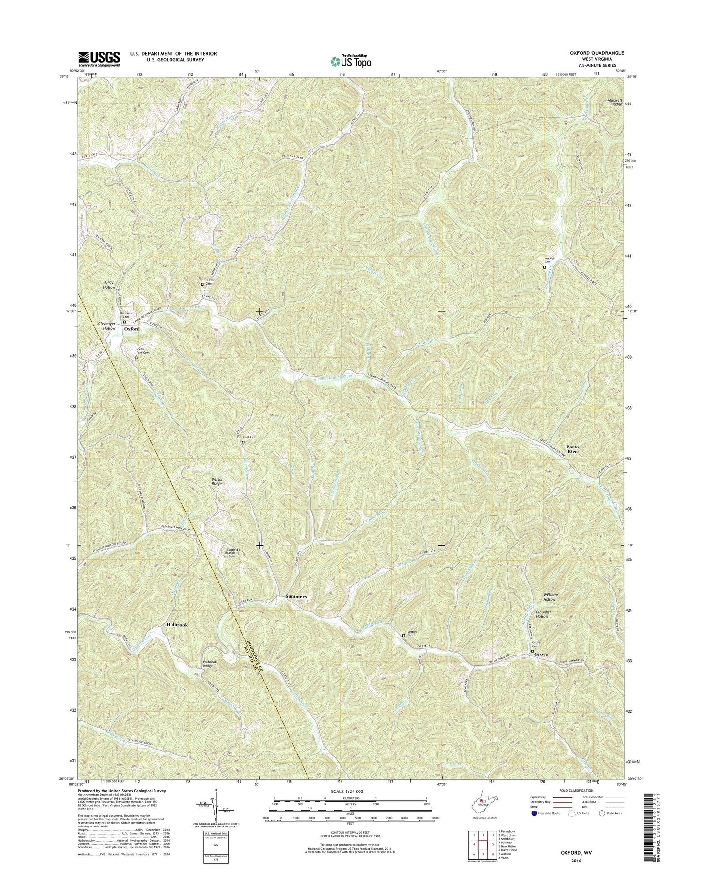
2019 topographic map quadrangle Oxford in the state of West Virginia. Scale: 1:24000. Based on the newly updated USGS 7.5' US Topo map series, this map is in the following counties: Doddridge, Ritchie. The map contains contour data, water features, and other items you are used to seeing on USGS maps, but also has updated roads and other features. This is the next generation of topographic maps. Printed on high-quality waterproof paper with UV fade-resistant inks.
Quads adjacent to this one:
West: Pullman
Northwest: Pennsboro
North: West Union
Northeast: Smithburg
East: New Milton
Southeast: Vadis
South: Auburn
Southwest: Burnt House
Contains the following named places: Big Run, Brush Run, Cabin Run Church, Cain Run, Camp Run, Camp Run School, Chapman Run, Clevenger Hollow, Dry Run, Freds Run, Gray Hollow, Grove, Grove Cemetery, Harmony School, Harmony United Methodist Church, Hart Cemetery, Hickory Run, Holbrook, Holbrook Bridge, Holt Run, Jims Run, Leason Cemetery, Leggett School, Long Run, Lower Run, Lower Run School, Lower Wizard Run, Maxwell Cemetery, Michaels Cemetery, Mudlick Run, Nutter Cemetery, Oxford, Oxford United Methodist Church, Painter Run, Pine Grove Church, Plaugher Hollow, Porto Rico, Sheep Run, Short Run, South Branch Church, South Branch East Cemetery, South Fork Baptist Church, South Fork Cemetery, Straight Fork, Sugar Run, Summers, Taylor Drain, Trap Run, Upper Arnold Creek School, Upper Cabin Run School, Upper Otterslide School, Upper Oxford School, Upper Run, Upper Wizard Run, Walnut Grove Church, Williams Hollow, Wilson Ridge