MyTopo
Pullman West Virginia US Topo Map
Couldn't load pickup availability
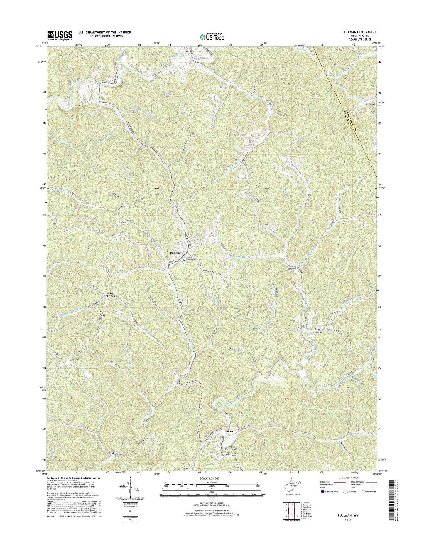
2023 topographic map quadrangle Pullman in the state of West Virginia. Scale: 1:24000. Based on the newly updated USGS 7.5' US Topo map series, this map is in the following counties: Ritchie, Doddridge. The map contains contour data, water features, and other items you are used to seeing on USGS maps, but also has updated roads and other features. This is the next generation of topographic maps. Printed on high-quality waterproof paper with UV fade-resistant inks.
Quads adjacent to this one:
West: Harrisville
Northwest: Ellenboro
North: Pennsboro
Northeast: West Union
East: Oxford
Southeast: Auburn
South: Burnt House
Southwest: Smithville
This map covers the same area as the classic USGS quad with code o39080b8.
Contains the following named places: Bear Run, Beason Church, Beason Run, Bee Run, Beeson School, Berea, Berea Post Office, Big Run, Buzzard Run, Davis Run, Five Forks, Goose Run, Isaac Fork, Joy, King Knob, Leason Run, Left Fork Slab Creek, Left Fork White Oak Creek, Little Beason Run, Little White Oak Creek, Lower Cabin Run School, Lower Lynncamp School, Lower Otterslide School, Lower Oxford School, Lower Whiteoak School, Lynncamp Run, Middle Fork, Mount Harmony School, Mount Pisgah Church, Mount Zion Church, Mount Zion School, Otterslide Creek, Pantherlick Run, Pine Grove Cemetery, Pine Grove Church, Pine Grove School, Poverty Hollow, Pullman, Pullman Church, Pullman Church Cemetery, Pullman Post Office, Pullman Structure One Dam, Riddle, Right Fork Slab Creek, Right Fork White Oak Creek, Ritchie Church, Slab, Spring Run, Star Fork, Straight Fork, Sugar Run, Taylor Cemetery, Town of Pullman, Trilby, Turtle Run, Union District, Upper Lynncamp School, Upper Whiteoak School, White Oak, White Oak Cemetery, White Oak Church, White Oak Creek, Wolfpen Run, ZIP Code: 26421