MyTopo
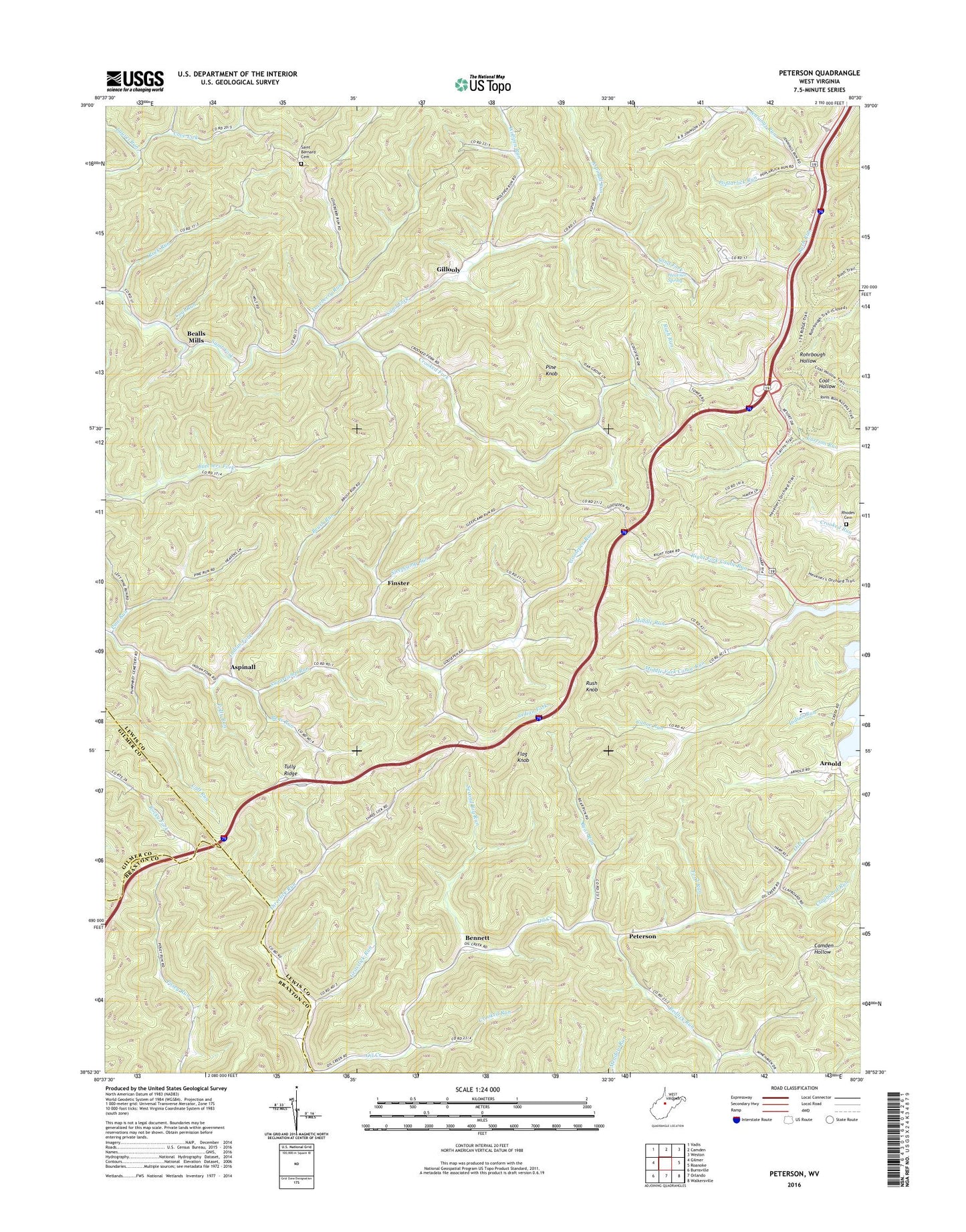
Peterson West Virginia US Topo Map
Couldn't load pickup availability
2019 topographic map quadrangle Peterson in the state of West Virginia. Scale: 1:24000. Based on the newly updated USGS 7.5' US Topo map series, this map is in the following counties: Lewis, Braxton, Gilmer. The map contains contour data, water features, and other items you are used to seeing on USGS maps, but also has updated roads and other features. This is the next generation of topographic maps. Printed on high-quality waterproof paper with UV fade-resistant inks.
Quads adjacent to this one:
West: Gilmer
Northwest: Vadis
North: Camden
Northeast: Weston
East: Roanoke
Southeast: Walkersville
South: Orlando
Southwest: Burnsville
Contains the following named places: Arnold, Aspinall, Aspinall Run, Bealls Mills, Bear Run, Bennett, Bens Run, Brush Run, Calf Run, Clapboard Run, Coal Run, Courthouse-Collins Settlement District, Crooked Fork, Crooked Run, Finster, Finster Chapel, Flag Knob, Flusher School, Ford Run, Gillooly, Goosepen Run, Goosepen School, Grasslick Run, Heavner Spring, Indian Run, Jennings Run, Laurel Run, Lewis County, Loveberry Run, Middle Fork Canoe Run, Middle Run, Nearway Run, Oak Grove Church, Oak Grove School, Peterson, Pine Knob, Pine Run, Pine Run School, Polly Run, Poplarlick Run, Raccoon Run, Redlick Run, Redlick School, Rhodes Cemetery, Right Fork Canoe Run, Roanoke Elementary School, Rock Run, Rush Knob, Saint Bernard Cemetery, Saint Bernards Church, Saint Bernards School, Saint Bridgets Church, Second Big Run, Sleepcamp Run, Sugarcamp Run, Threelick School, Tully Ridge, Ward School, White Doll School, Wolfpen Run, Wyant School