MyTopo
Vadis West Virginia US Topo Map
Couldn't load pickup availability
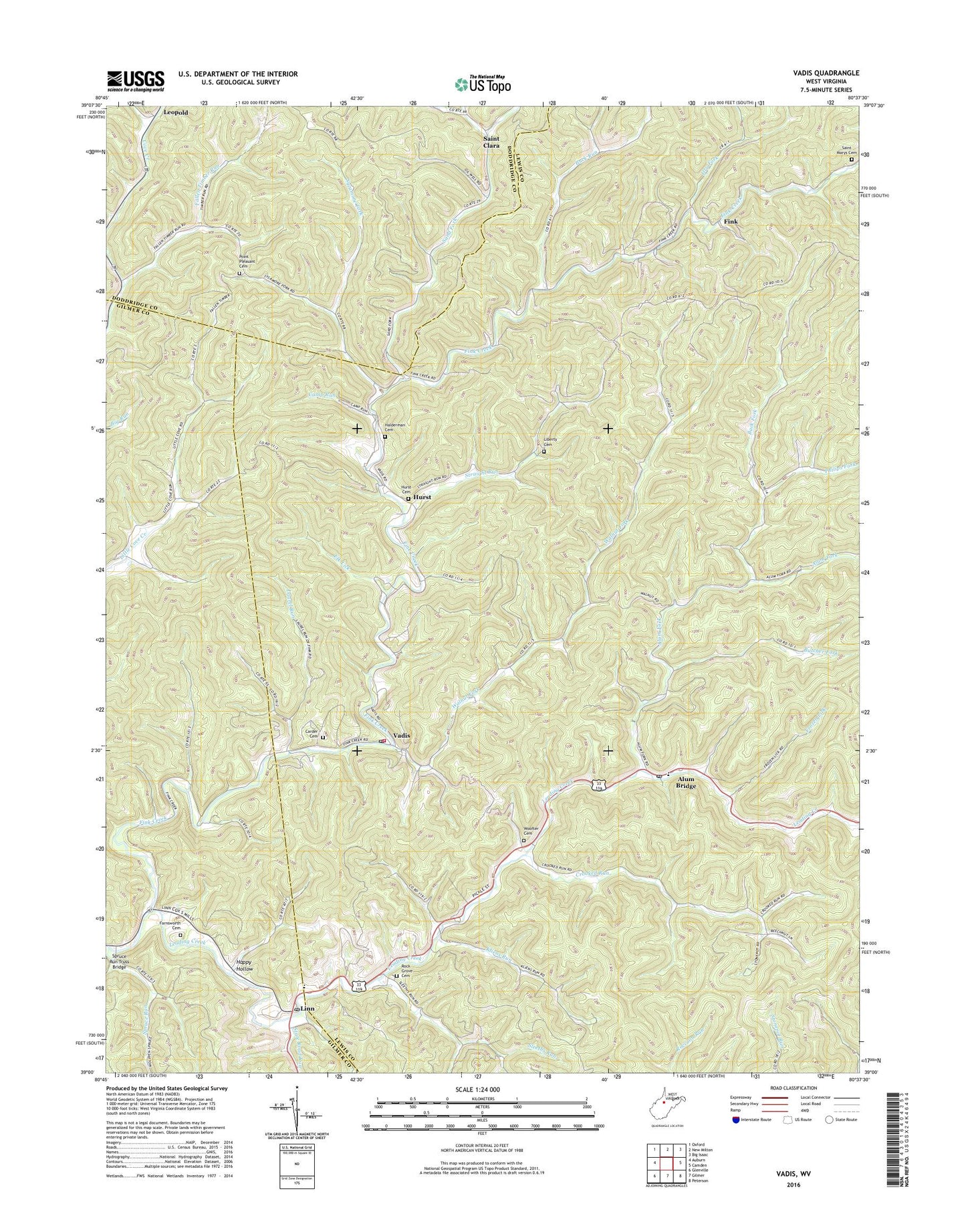
2019 topographic map quadrangle Vadis in the state of West Virginia. Scale: 1:24000. Based on the newly updated USGS 7.5' US Topo map series, this map is in the following counties: Lewis, Gilmer, Doddridge. The map contains contour data, water features, and other items you are used to seeing on USGS maps, but also has updated roads and other features. This is the next generation of topographic maps. Printed on high-quality waterproof paper with UV fade-resistant inks.
Quads adjacent to this one:
West: Auburn
Northwest: Oxford
North: New Milton
Northeast: Big Isaac
East: Camden
Southeast: Peterson
South: Gilmer
Southwest: Glenville
Contains the following named places: Alum Bridge, Alum Bridge Elementary School, Alum Bridge Post Office, Alum Fork, Back Fork, Back Fork School, Buck Run, Buck Run School, Burton Run, Butcher Fork, Butcher Fork School, Camp Run, Carder Cemetery, Carmel Church, Crooked Run, Crooked Run School, Doyle Chapel, Dry Fork, Dry Fork School, Elk Lick, Fallen Timber Run, Farnsworth Cemetery, Fink, Fink Creek, Frozen Lick, Halderman Cemetery, Happy Hollow, Hopewell School, Hurst, Hurst Cemetery, Kliens Run, Laurel Run, Laurel Run School, Liberty Cemetery, Liberty Church, Linn, Linn Post Office, Little Buck Run, Little Cove School, Lower Saint Clara School, Lower Walnut School, Meadow View School, Midway Volunteer Fire Department, Philips Fork, Pickle Street, Pine Grove School, Point Pleasant Baptist Church, Point Pleasant Cemetery, Rock Grove Cemetery, Rock Grove Church, Saint Boniface Church, Saint Clara, Saint Marys Cemetery, Sand Fork, Sleeths Run, Spruce Run, Spruce Run Truss Bridge, State Road Run, Straight Run, Straight Run School, Sugar Grove School, Sycamore Fork, Upper Walnut School, Vadis, Vadis Post Office, Walnut Fork, Woofter Cemetery, ZIP Code: 26321