
MyTopo
Bangor Wisconsin US Topo Map
Couldn't load pickup availability
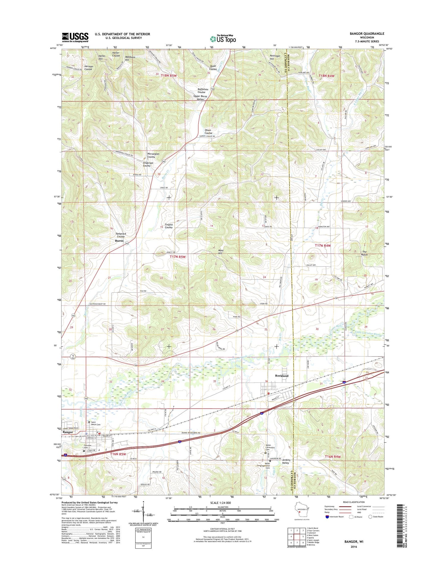
2018 topographic map quadrangle Bangor in the state of Wisconsin. Scale: 1:24000. Based on the newly updated USGS 7.5' US Topo map series, this map is in the following counties: La Crosse, Monroe. The map contains contour data, water features, and other items you are used to seeing on USGS maps, but also has updated roads and other features. This is the next generation of topographic maps. Printed on high-quality waterproof paper with UV fade-resistant inks.
Quads adjacent to this one:
West: West Salem
Northwest: North Bend
North: Four Corners
Northeast: Cataract
East: Sparta
Southeast: Melvina
South: Middle Ridge
Southwest: Saint Joseph
Contains the following named places: 17 Reservoir, 54614, Anderson Coulee, Bangor, Bangor - Burns Fire Department Rockland Station, Bangor - Burns Volunteer Fire Department, Bangor Elementary School, Bangor Middle School, Bangor Police Department, Bangor Post Office, Big Creek, Big Creek Church, Burns, Burns Dam, Burns Valley Church, Culpitt Coulee, Dutch Creek, East Upper Big Creek, Elm Grove School, Fairview Cemetery, Fish Creek, Fish Creek School, Heller Hill, Hill Grove School, Jenkins Valley, La Crosse River Trail Prairies State Natural Area, Little LaCrosse River, Lower Big Creek School, Moss Hill, Norwegian Coulee, Olson Coulee, Pettinger Hill, Prairie School, Progressive School, Quall Coulee, Raffelson Coulee, Rockland, Rockland Post Office, Saint Marys Cemetery, Saint Paul's Evangelical Lutheran School, Striped School, Tamarack Coulee, The Notch, Town of Burns, Upper Big Creek, Upper Burns Valley, Village of Bangor, Village of Rockland, Waldness Hill, Webster Field, Welsh Calvanistic Cemetery, Welsh Congregational Cemetery, White School


