MyTopo
North Bend Wisconsin US Topo Map
Couldn't load pickup availability
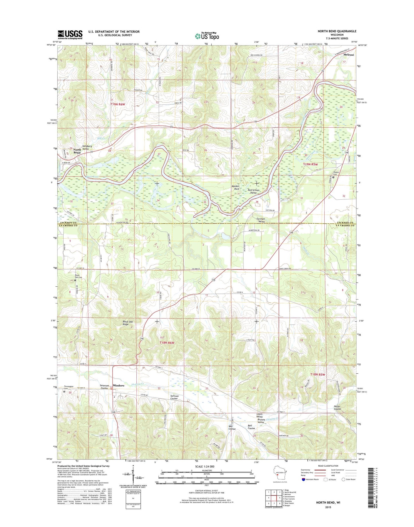
2022 topographic map quadrangle North Bend in the state of Wisconsin. Scale: 1:24000. Based on the newly updated USGS 7.5' US Topo map series, this map is in the following counties: La Crosse, Jackson. The map contains contour data, water features, and other items you are used to seeing on USGS maps, but also has updated roads and other features. This is the next generation of topographic maps. Printed on high-quality waterproof paper with UV fade-resistant inks.
Quads adjacent to this one:
West: Stevenstown
Northwest: Hegg
North: North Bend NE
Northeast: Melrose
East: Four Corners
Southeast: Bangor
South: West Salem
Southwest: Onalaska
This map covers the same area as the classic USGS quad with code o44091a1.
Contains the following named places: Bell Coulee, Black Oak Cemetery, Black Oak Ridge, Black Oak School, Browns Valley, Burr Oak, Burr Oak Lutheran Cemetery, Burr Oak Methodist Cemetery, Burr Oak School, Camp Ehawee, Davis Creek, Farmington Cemetery, Farmington Volunteer Fire Department, German Valley, Heller Coulee, Little Red School, Maiden Rock, Melrose - Mindoro High School, Mill Creek, Mill Creek School, Mindoro, Mindoro Census Designated Place, Mindoro Elementary School, Mindoro Post Office, North Bend, Oxbow Cemetery, Oxbow School, Pfaff School, Red School Valley, Rhyme School, Sand Creek, Sandberg Valley, Severson Coulee, Sullivan Coulee, Town of Farmington, Town of Melrose, Town of North Bend, Wet Coulee, Wilson Creek, ZIP Code: 54644