MyTopo
Cataract Wisconsin US Topo Map
Couldn't load pickup availability
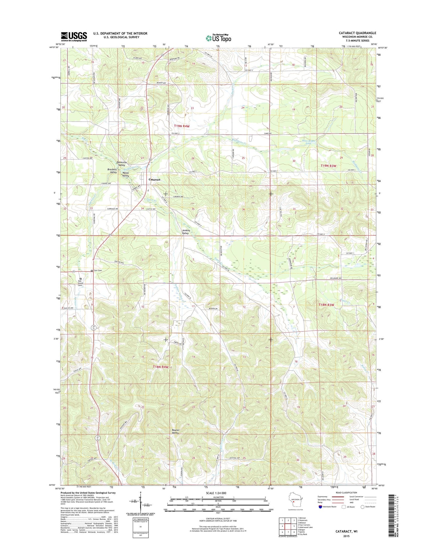
2018 topographic map quadrangle Cataract in the state of Wisconsin. Scale: 1:24000. Based on the newly updated USGS 7.5' US Topo map series, this map is in the following counties: Monroe. The map contains contour data, water features, and other items you are used to seeing on USGS maps, but also has updated roads and other features. This is the next generation of topographic maps. Printed on high-quality waterproof paper with UV fade-resistant inks.
Quads adjacent to this one:
West: Four Corners
Northwest: Melrose
North: Shamrock
Northeast: Millston
East: Alderwood Lake
Southeast: City Rock
South: Sparta
Southwest: Bangor
Contains the following named places: Big Creek State Fishery Area, Brackett School, Brackett Valley, Bush Prairie School, Carr Cemetery, Cataract, Cataract Census Designated Place, Cataract Community Post Office, Cataract Elementary School, Cataract Lookout Tower, Cataract Pond, Daneville School, Daneville Valley, Dustin Creek, Endres School, Evans Pond State Fishery Area, Glass Church, Hans Beigel Pond, Jenkins Valley, Jenkins Valley Creek, Jenkins Valley School, Oak Grove Cemetery, Rathbone Creek, Soper Creek, Spencer Creek, Town of Little Falls, Welsh Valley, Welsh Valley School