MyTopo
Millston Wisconsin US Topo Map
Couldn't load pickup availability
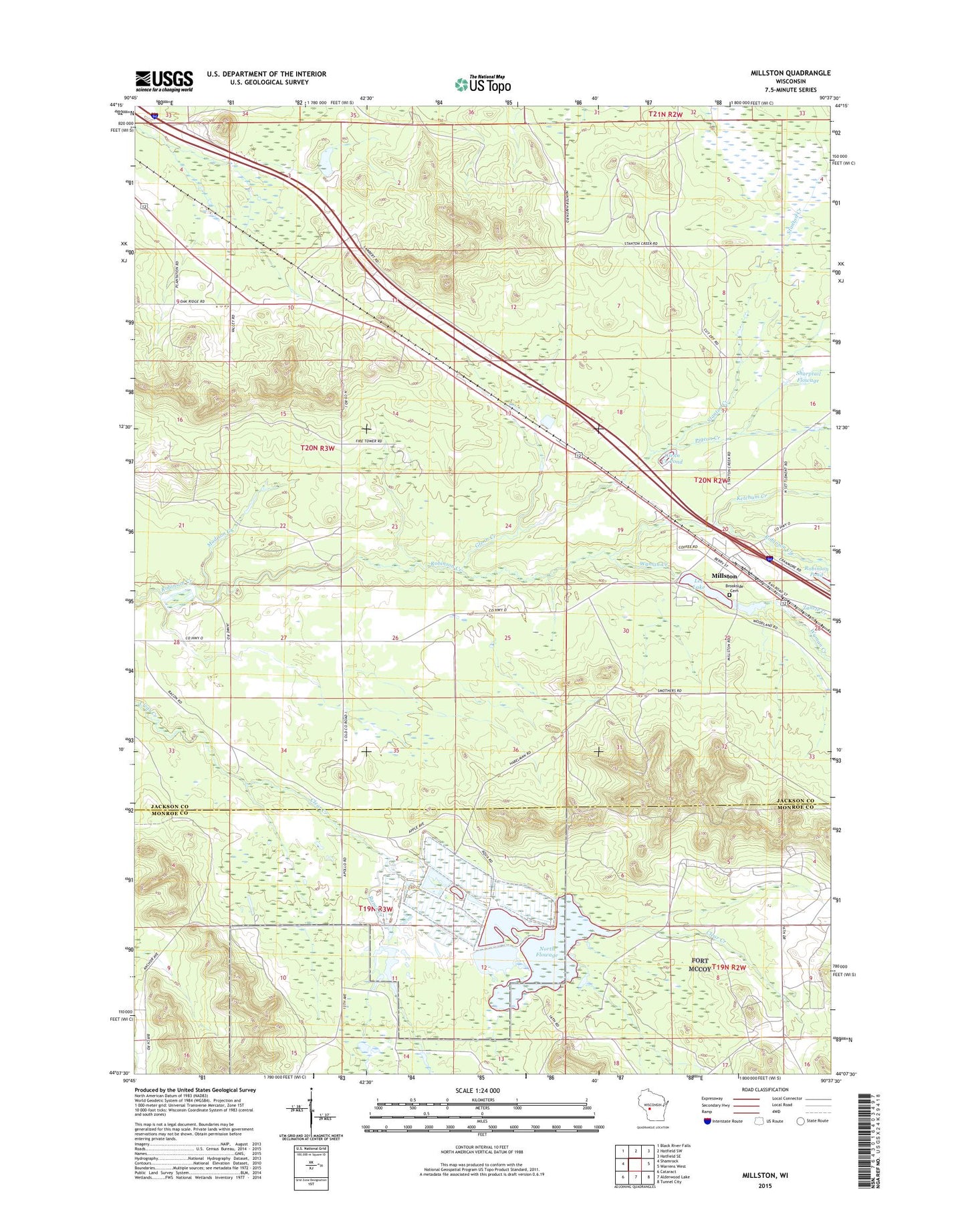
2022 topographic map quadrangle Millston in the state of Wisconsin. Scale: 1:24000. Based on the newly updated USGS 7.5' US Topo map series, this map is in the following counties: Jackson, Monroe. The map contains contour data, water features, and other items you are used to seeing on USGS maps, but also has updated roads and other features. This is the next generation of topographic maps. Printed on high-quality waterproof paper with UV fade-resistant inks.
Quads adjacent to this one:
West: Shamrock
Northwest: Black River Falls
North: Hatfield SW
Northeast: Hatfield SE
East: Warrens West
Southeast: Tunnel City
South: Alderwood Lake
Southwest: Cataract
This map covers the same area as the classic USGS quad with code o44090b6.
Contains the following named places: 10 Reservoir, 54643, 60 Reservoir, Brookside Cemetery, Glenn Creek, Glenn Creek Pond, Habelman Dam, Janke WP 445 Dam, Ketchum Creek, Lee Lake, Lee Lake 15, Lees Crossing, Madison Creek, Millston, Millston Census Designated Place, Millston Dam, Millston Post Office, North Flowage, Oak Ridge Fire Tower, Pigeon Creek, Ranch Creek, Robinson Creek Pines State Natural Area, Sharptail Flowage, Stanton Creek, Washburn Marsh State Natural Area, Wyman Creek, Zahrte Creek