MyTopo
Colfax North Wisconsin US Topo Map
Couldn't load pickup availability
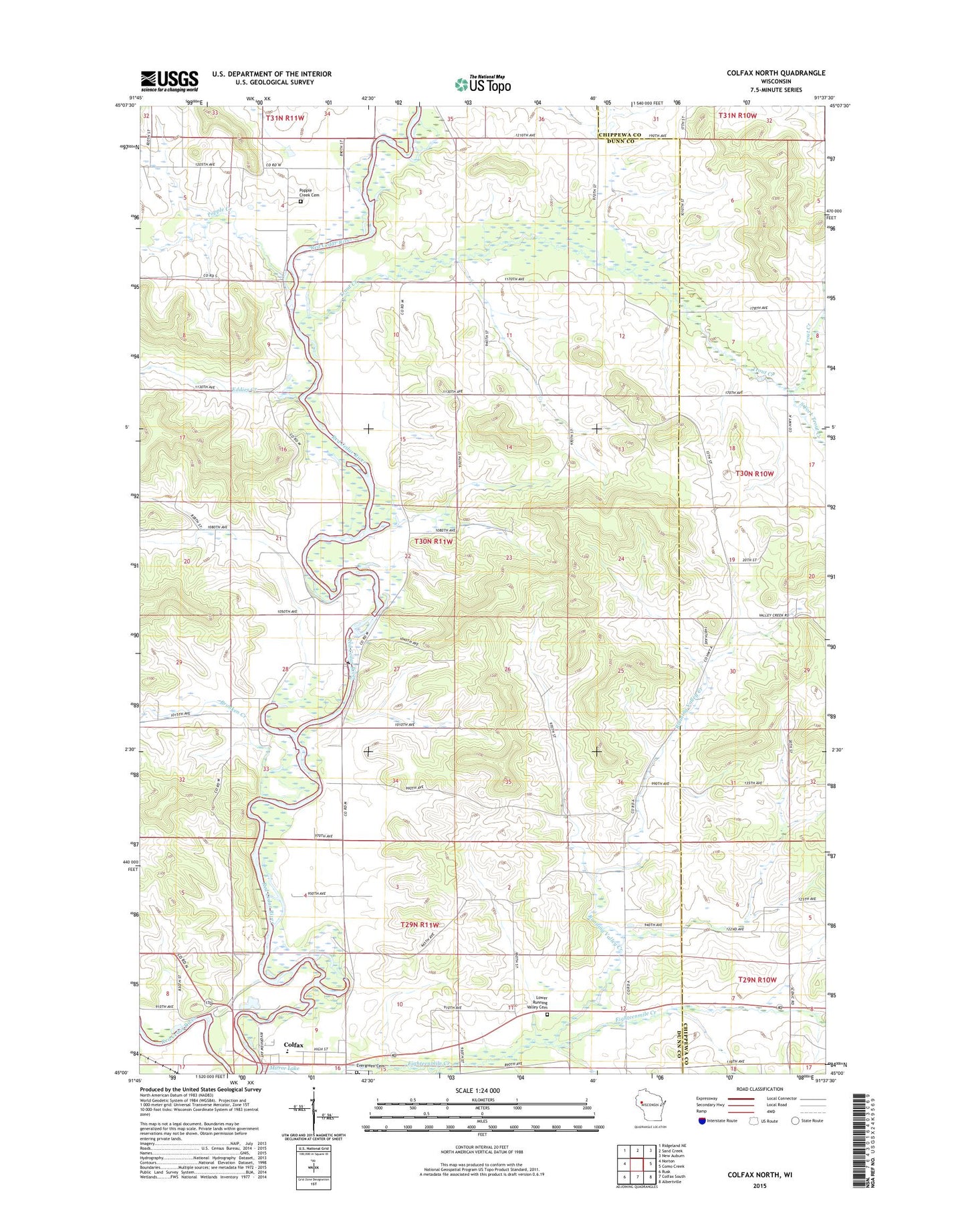
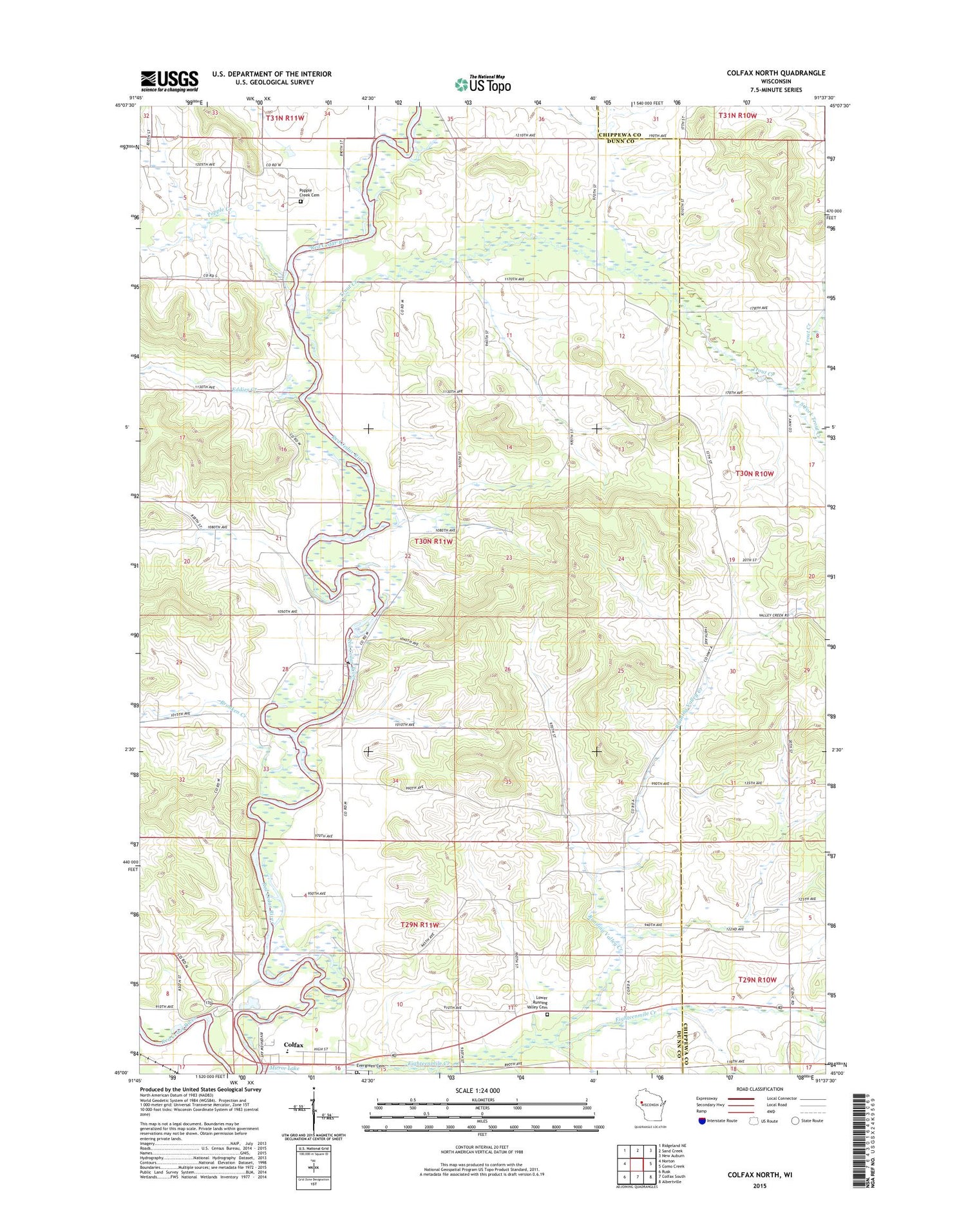
2018 topographic map quadrangle Colfax North in the state of Wisconsin. Scale: 1:24000. Based on the newly updated USGS 7.5' US Topo map series, this map is in the following counties: Dunn, Chippewa. The map contains contour data, water features, and other items you are used to seeing on USGS maps, but also has updated roads and other features. This is the next generation of topographic maps. Printed on high-quality waterproof paper with UV fade-resistant inks.
Quads adjacent to this one:
West: Norton
Northwest: Ridgeland NE
North: Sand Creek
Northeast: New Auburn
East: Como Creek
Southeast: Albertville
South: Colfax South
Southwest: Rusk
Contains the following named places: Bronken Creek, Colfax Elementary School, Colfax High School, Colfax Middle School, Colfax Wastewater Treatment Facility, County Line Farms, Eddies Creek, Eighteenmile Creek, Evergreen Cemetery, Everson School, Faith Church, Grant Townhall, Holden Church, Howard Townhall, Lower Running Valley Cemetery, Mirror Lake, North Running Valley Church, Oak Hill School, Popple Creek, Popple Creek Cemetery, Popple Creek School, Riverview School, Running Valley Creek, Running Valley School, Saint Johns Church, South Fork Trout Creek, Town of Grant, Trout Creek, Trout Creek School, Twentytwo Mile Ford Park, Valley Glen School, ZIP Code: 54730