MyTopo
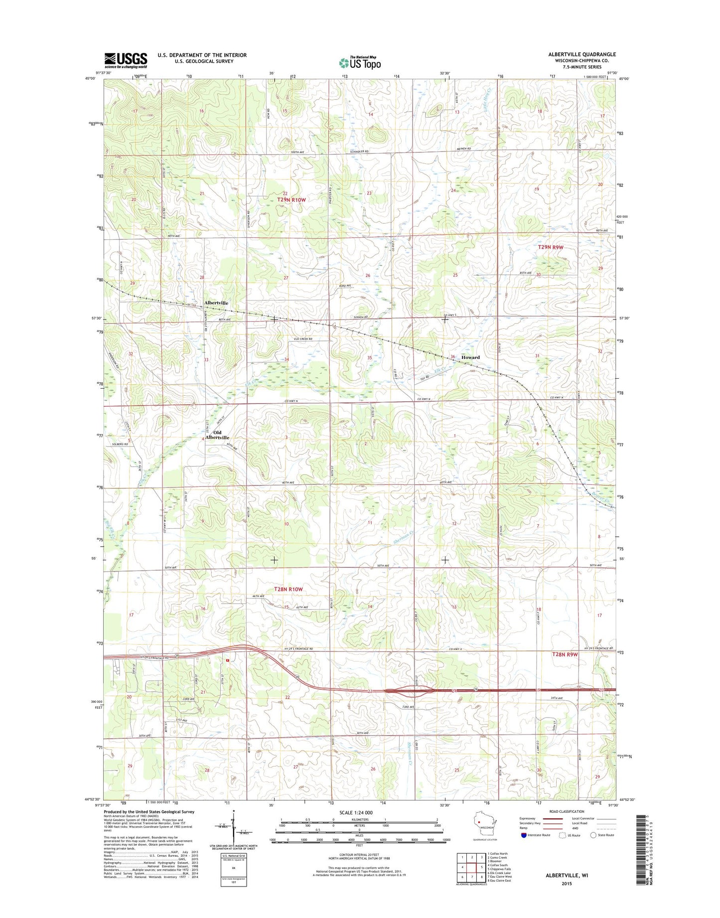
Albertville Wisconsin US Topo Map
Couldn't load pickup availability
2022 topographic map quadrangle Albertville in the state of Wisconsin. Scale: 1:24000. Based on the newly updated USGS 7.5' US Topo map series, this map is in the following counties: Chippewa. The map contains contour data, water features, and other items you are used to seeing on USGS maps, but also has updated roads and other features. This is the next generation of topographic maps. Printed on high-quality waterproof paper with UV fade-resistant inks.
Quads adjacent to this one:
West: Colfax South
Northwest: Colfax North
North: Como Creek
Northeast: Bloomer
East: Chippewa Falls
Southeast: Eau Claire East
South: Eau Claire West
Southwest: Elk Creek Lake
This map covers the same area as the classic USGS quad with code o44091h5.
Contains the following named places: Albertville, Big Elk Creek, Elk Creek School, Elk Creek State Public Fishing Area, Flying R Ranch, Hillside School, Howard, Old Albertville, Steinmetz Dairy Farm, Sundance Hill Farms, Sunny Valley School, Thorncreek Farm, Town of Howard, Town of Wheaton, WECL-FM (Elk Mound), Wheaton Fire and Rescue, Wheaton Generating Station, Wheaton Substation