MyTopo
Deerfield Wisconsin US Topo Map
Couldn't load pickup availability
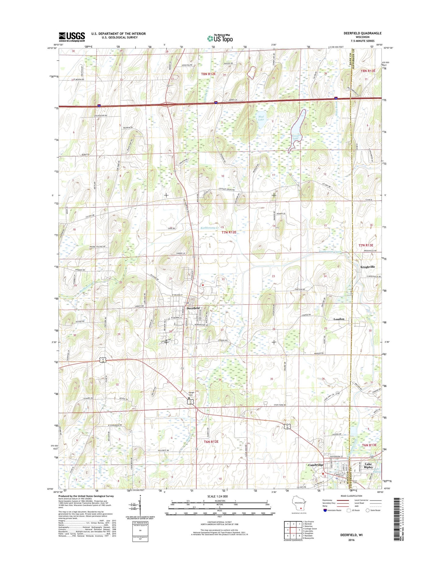
2018 topographic map quadrangle Deerfield in the state of Wisconsin. Scale: 1:24000. Based on the newly updated USGS 7.5' US Topo map series, this map is in the following counties: Dane, Jefferson. The map contains contour data, water features, and other items you are used to seeing on USGS maps, but also has updated roads and other features. This is the next generation of topographic maps. Printed on high-quality waterproof paper with UV fade-resistant inks.
Quads adjacent to this one:
West: Cottage Grove
Northwest: Sun Prairie
North: Marshall
Northeast: Waterloo
East: Lake Mills
Southeast: Busseyville
South: Rockdale
Southwest: Stoughton
Contains the following named places: Cambridge, Cambridge Area Emergency Medical Services, Cambridge Elementary School, Cambridge High School, Cambridge Police Department, Cambridge Post Office, Cambridge Volunteer Fire Department, Christiana Farms, Coolwater Farms, Deerfield, Deerfield Elementary School, Deerfield High School, Deerfield Lutheran Cemetery, Deerfield Middle School, Deerfield Police Department, Deerfield Post Office, Deerfield Volunteer Fire Department, Deerfield Wastewater Treatment Plant, Gerike Cemetery, Goose Lake, Goose Lake Drumlins State Natural Area, Goose Lake State Wildlife Area, Hauge Cemetery, Immanuel Church, Kroghville, Lake Ripley Cemetery, Liberty Lutheran Cemetery, Liberty School, London, Lutheran Moravian Cemetery, Mikkelson Farm, Mud Creek, Mud Lake, Nikolay Middle School, Oak Park, Oak Park School, Old Deerfield, Pioneer Norwegian Cemetery, Prairie Queen School, Saint Anne's Catholic Cemetery, Saint Paul Church, Smithback Farm, Town of Deerfield, Vasby Farms, Village of Cambridge, Village of Deerfield, Willerup Methodist Cemetery, WTFX-FM (Watertown), ZIP Code: 53531