MyTopo
Waterloo Wisconsin US Topo Map
Couldn't load pickup availability
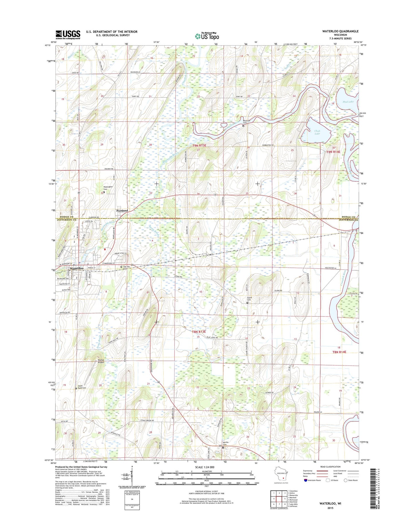
2022 topographic map quadrangle Waterloo in the state of Wisconsin. Scale: 1:24000. Based on the newly updated USGS 7.5' US Topo map series, this map is in the following counties: Jefferson, Dodge. The map contains contour data, water features, and other items you are used to seeing on USGS maps, but also has updated roads and other features. This is the next generation of topographic maps. Printed on high-quality waterproof paper with UV fade-resistant inks.
Quads adjacent to this one:
West: Marshall
Northwest: Columbus
North: Astico
Northeast: Reeseville
East: Richwood
Southeast: Jefferson
South: Lake Mills
Southwest: Deerfield
This map covers the same area as the classic USGS quad with code o43088b8.
Contains the following named places: Chub Lake, City of Waterloo, City of Waterloo Cemetery, Faville Prairie State Natural Area, Firemen Park, Holy Family School, Hubbleton, Jordan Cemetery, Maunesha River, Moravian Cemetery, Mud Lake, Neville Cemetery, Oak Hill Cemetery, Portland, Saint John Lutheran School, Saint Josephs Catholic Church, Saint Pauls Lutheran Church, Saint Wenceslaus Church, Setz Cemetery, Snapper Prairie State Natural Area, South Road Cemetery, Stony Brook, Tesmer Airport, Town of Portland, Town of Waterloo, Washington Cemetery, Waterloo, Waterloo Elementary School, Waterloo Fire and Rescue Department, Waterloo High School, Waterloo Intermediate School, Waterloo Middle School, Waterloo Police Department, Waterloo Post Office, Waterloo Prairie State Natural Area, Waterloo Wastewater Treatment Facility, ZIP Code: 53594