MyTopo
Dickeyville Wisconsin US Topo Map
Couldn't load pickup availability
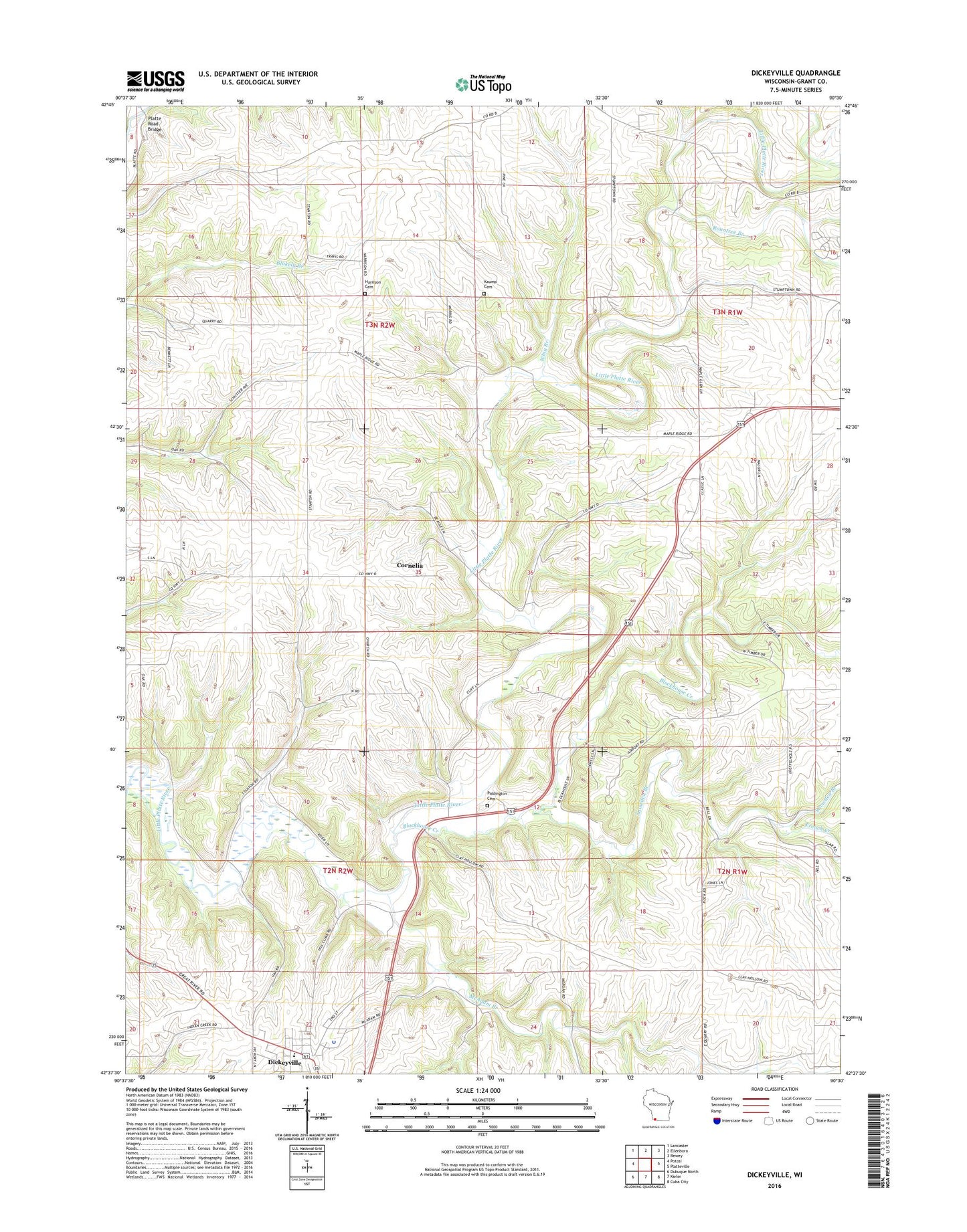
2018 topographic map quadrangle Dickeyville in the state of Wisconsin. Scale: 1:24000. Based on the newly updated USGS 7.5' US Topo map series, this map is in the following counties: Grant. The map contains contour data, water features, and other items you are used to seeing on USGS maps, but also has updated roads and other features. This is the next generation of topographic maps. Printed on high-quality waterproof paper with UV fade-resistant inks.
Quads adjacent to this one:
West: Potosi
Northwest: Lancaster
North: Ellenboro
Northeast: Rewey
East: Platteville
Southeast: Cuba City
South: Kieler
Southwest: Dubuque North
Contains the following named places: Blockhouse Creek, Brogley Farms, Center School, Cornelia, Dickeyville, Dickeyville Elementary School, Dickeyville Police Department, Dickeyville Post Office, French Creek, Grimes Farm, Harrison Cemetery, Holy Ghost Immaculate Conception School, Kaump Cemetery, Little Grant Mine, Maple Glen School, McAdam Branch, Mount Zion Church, Piddington Cemetery, Platte Road Bridge, Platteville Wastewater Treatment Facility, R and R Farms, Rountree Branch, Saddleback Farms, Snowden Branch, Town of Harrison, Town of Paris, Vannatta Farms, Whig Branch, Young Branch, ZIP Code: 53808