MyTopo
Potosi Wisconsin US Topo Map
Couldn't load pickup availability
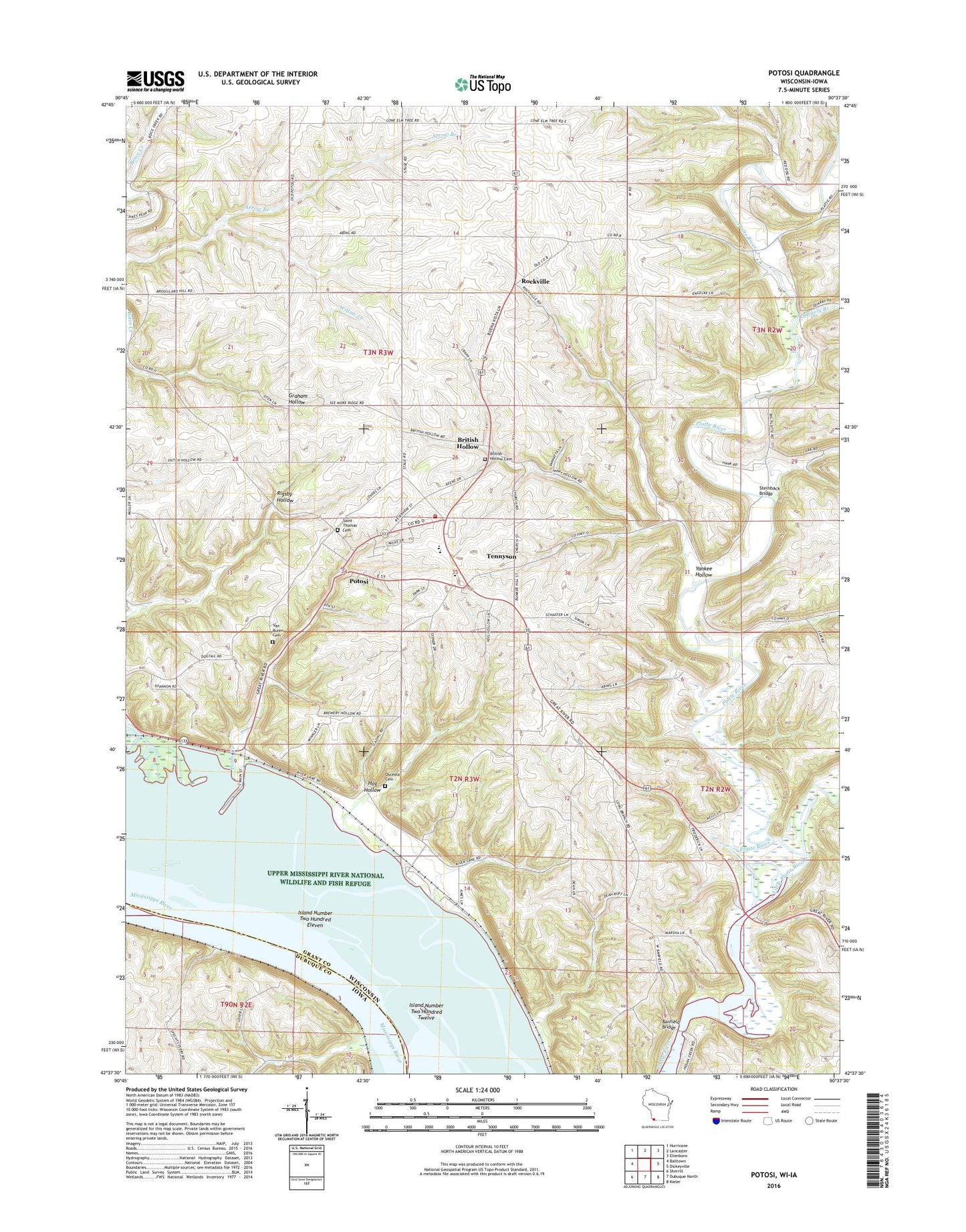
2022 topographic map quadrangle Potosi in the states of Wisconsin, Iowa. Scale: 1:24000. Based on the newly updated USGS 7.5' US Topo map series, this map is in the following counties: Grant, Dubuque. The map contains contour data, water features, and other items you are used to seeing on USGS maps, but also has updated roads and other features. This is the next generation of topographic maps. Printed on high-quality waterproof paper with UV fade-resistant inks.
Quads adjacent to this one:
West: Balltown
Northwest: Hurricane
North: Lancaster
Northeast: Ellenboro
East: Dickeyville
Southeast: Kieler
South: Dubuque North
Southwest: Sherrill
This map covers the same area as the classic USGS quad with code o42090f6.
Contains the following named places: Banfield Bridge, Blakely Branch, British Hollow, British Hollow Cemetery, Buena Vista, Davies Memorial United Church of Christ, Grant River, Grant River Recreation Area, Hog Hollow, Island Number Two Hundred Eleven, Island Number Two Hundred Twelve, Koeller and Klein Dam, Little Platte River, McKnight Post Light, Osceola Cemetery, Potosi, Potosi Canal, Potosi Creek, Potosi Elementary School, Potosi High School, Potosi Middle School, Potosi Police Department, Potosi Post Office, Potosi Rescue Squad, Potosi School, Potosi Station, Potosi Volunteer Fire Department, Rigsby School, Rockville, Saint Andrew Church, Saint Mathias Female Seminary, Saint Thomas Catholic Church, Saint Thomas Cemetery, Saints Andrew and Thomas School, Spechts Ferry, Spechts Ferry Post Office, Steinback Bridge, Tennyson, Town of Potosi, Ulbrick Quarry, Van Buren, Van Buren Cemetery, Village of Potosi, Village of Tennyson, Willow Creek, WKPL-FM (Platteville), Yankee Hollow, ZIP Code: 53820