MyTopo
Esofea Wisconsin US Topo Map
Couldn't load pickup availability
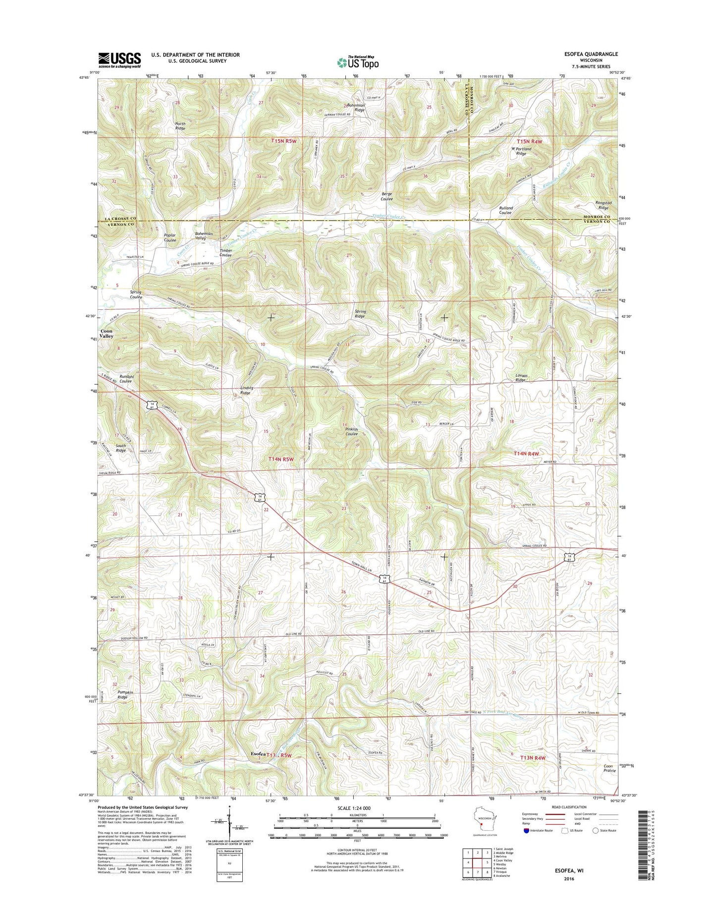
2018 topographic map quadrangle Esofea in the state of Wisconsin. Scale: 1:24000. Based on the newly updated USGS 7.5' US Topo map series, this map is in the following counties: Vernon, La Crosse, Monroe. The map contains contour data, water features, and other items you are used to seeing on USGS maps, but also has updated roads and other features. This is the next generation of topographic maps. Printed on high-quality waterproof paper with UV fade-resistant inks.
Quads adjacent to this one:
West: Coon Valley
Northwest: Saint Joseph
North: Middle Ridge
Northeast: Melvina
East: Westby
Southeast: Avalanche
South: Viroqua
Southwest: Newton
Contains the following named places: Berge Coulee, Bethany Lutheran Church, Bohemian Ridge, Bohemian Valley, Coon Creek 53 D6025 Dam, Coon Creek Cliffs State Natural Area, Coon Valley Quarry, Dahlen School, Eid School, Eide School, Erickson School, Esofea, Esofea County Park, German Coulee, Lindvig Ridge, Lium School, Lovaas Ridge, Nerison School, North Natwick School, North Ridge, Poplar Coulee, Rulland Coulee, Rullands Coulee Creek, Rundahl Coulee, Skogdalen Church, Smith School, South Ridge, Spring Coulee, Spring Coulee School, Spring Ridge, Timber Coulee, Timber Coulee Creek, Town of Coon, Upseth School, Urbanek Family Cemetery, Vang Lutheran Church, Von Ruden Memorial Park, Von Ruden School, West Portland Ridge, Westby School