MyTopo
Newton Wisconsin US Topo Map
Couldn't load pickup availability
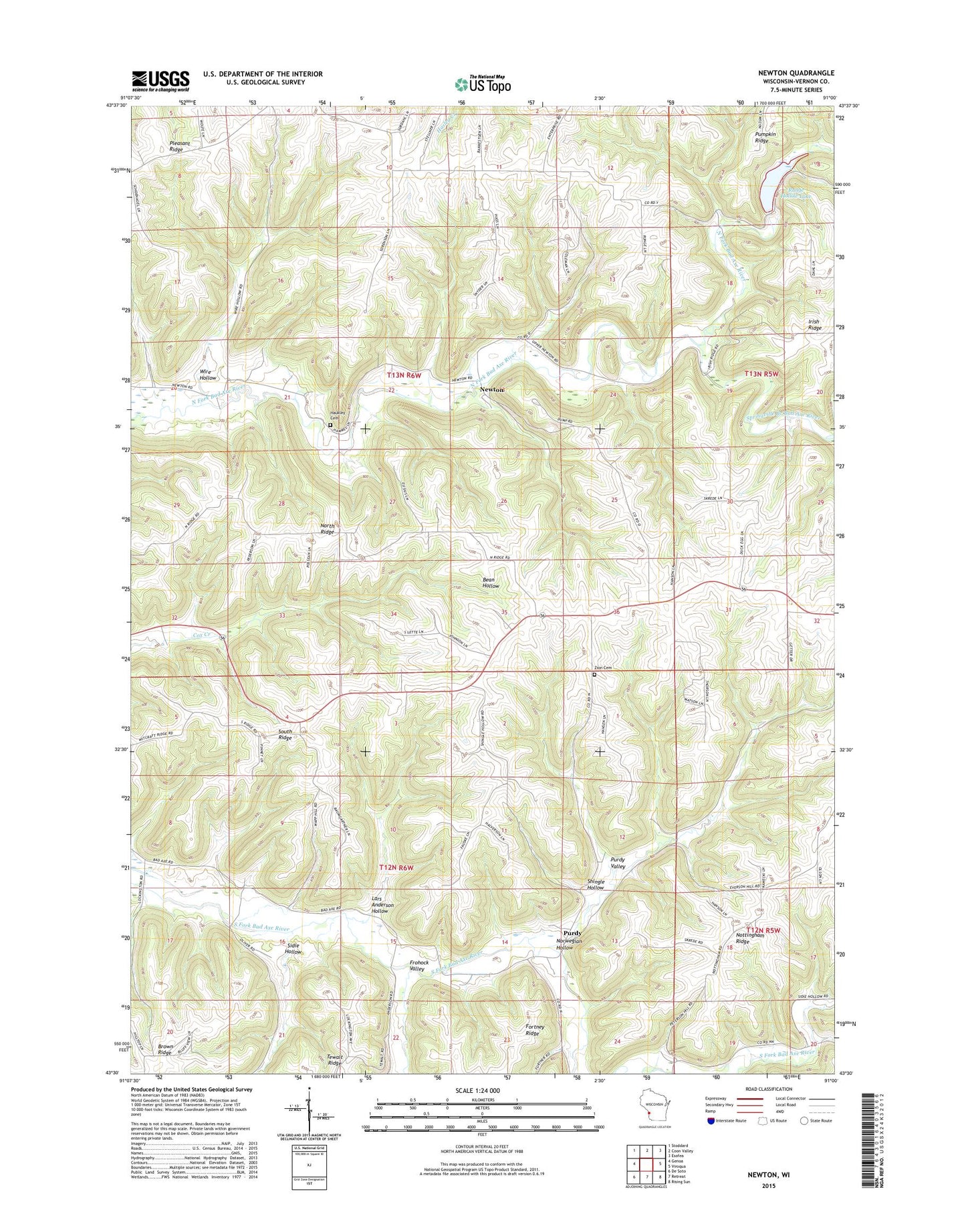
2022 topographic map quadrangle Newton in the state of Wisconsin. Scale: 1:24000. Based on the newly updated USGS 7.5' US Topo map series, this map is in the following counties: Vernon. The map contains contour data, water features, and other items you are used to seeing on USGS maps, but also has updated roads and other features. This is the next generation of topographic maps. Printed on high-quality waterproof paper with UV fade-resistant inks.
Quads adjacent to this one:
West: Genoa
Northwest: Stoddard
North: Coon Valley
Northeast: Esofea
East: Viroqua
Southeast: Rising Sun
South: Retreat
Southwest: De Soto
This map covers the same area as the classic USGS quad with code o43091e1.
Contains the following named places: Bad Axe 12 2WP2542 Dam, Bad Axe Lutheran Church, Baker School, Clawson School, Collence School, Enterprise School, Evening Star School, Frohock Valley, Harmony School, Haukley Cemetery, Lars Anderson Hollow, Newton, North Ridge, Norwegian Hollow, Nottingham School, Plainview School, Pleasant Ridge, Purdy, Purdy School, Purdy Valley, Runge Hollow Lake 30, Shingle Hollow, Sidie Hollow, South Ridge, South Ridge School, Springville Branch Bad Axe River, Town of Harmony, White Pigeon School, Wire Hollow, Zion Cemetery, Zion Church