MyTopo
Jump River Fire Tower NE Wisconsin US Topo Map
Couldn't load pickup availability
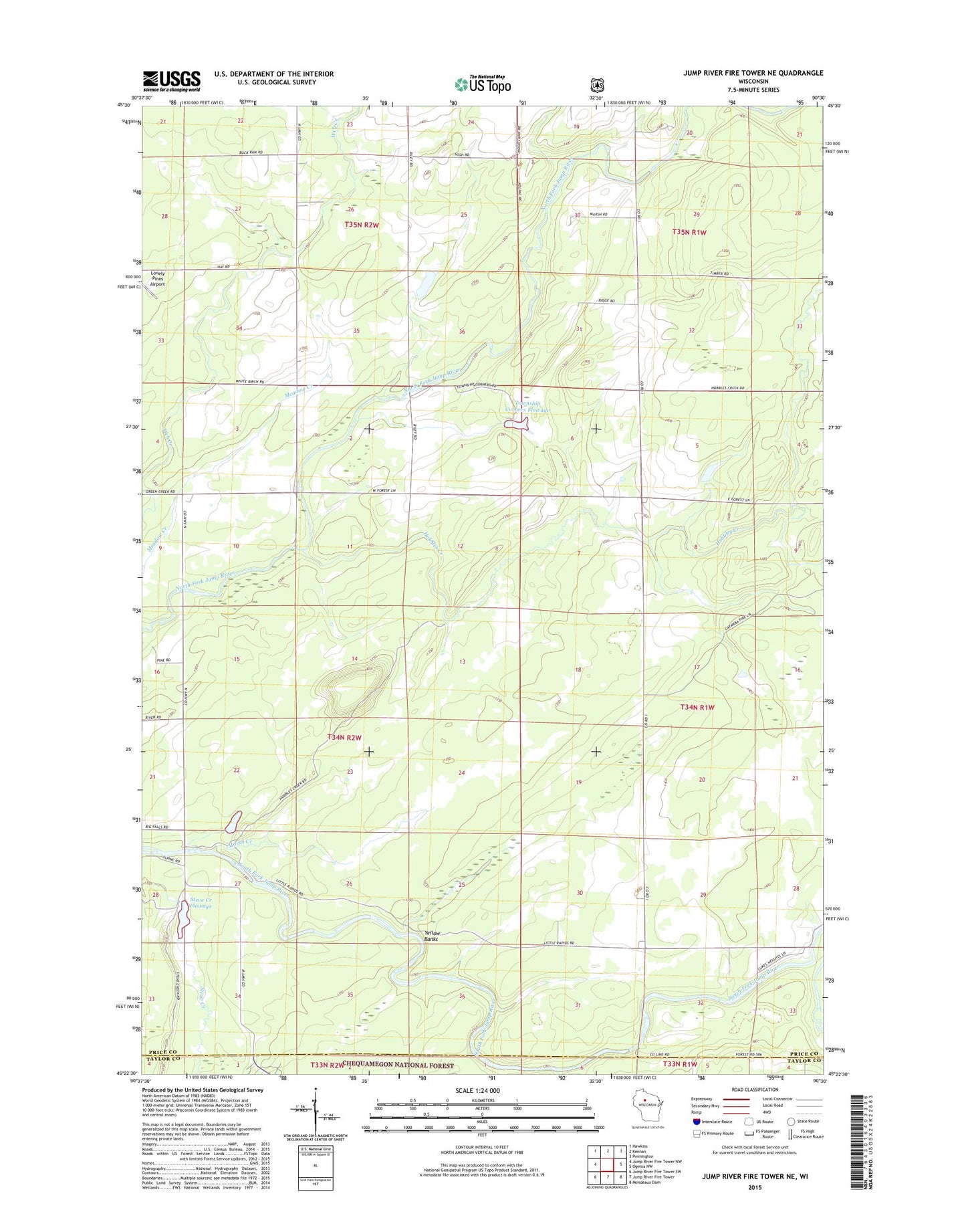
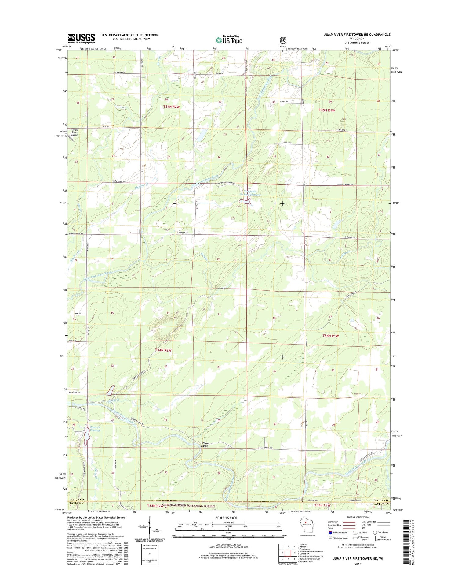
2018 topographic map quadrangle Jump River Fire Tower NE in the state of Wisconsin. Scale: 1:24000. Based on the newly updated USGS 7.5' US Topo map series, this map is in the following counties: Price, Taylor. The map contains contour data, water features, and other items you are used to seeing on USGS maps, but also has updated roads and other features. This is the next generation of topographic maps. Printed on high-quality waterproof paper with UV fade-resistant inks.
Quads adjacent to this one:
West: Jump River Fire Tower NW
Northwest: Hawkins
North: Kennan
Northeast: Pennington
East: Ogema NW
Southeast: Mondeaux Dam
South: Jump River Fire Tower
Southwest: Jump River Fire Tower SW
Contains the following named places: 1 Reservoir, Fairview School, Hobbles Creek, Lonely Pines Airport, Lower Steve Creek 2WP1332 Dam, Marsh Creek, Meadow Creek School, Red Tile School, Ronald Winter H1876 Dam, Steve Creek Flowage, Town Corners Wildlife Flowage E12.67 Dam, Town of Kennan, Township Corners Flowage, Township Corners State Wildlife Management Area, Yellow Banks