MyTopo
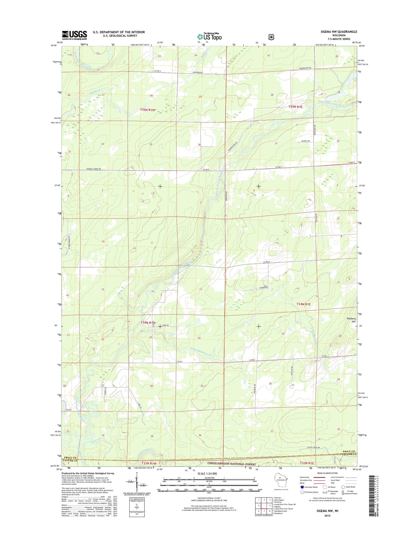
Ogema NW Wisconsin US Topo Map
Couldn't load pickup availability
Also explore the Ogema NW Forest Service Topo of this same quad for updated USFS data
2022 topographic map quadrangle Ogema NW in the state of Wisconsin. Scale: 1:24000. Based on the newly updated USGS 7.5' US Topo map series, this map is in the following counties: Price, Taylor. The map contains contour data, water features, and other items you are used to seeing on USGS maps, but also has updated roads and other features. This is the next generation of topographic maps. Printed on high-quality waterproof paper with UV fade-resistant inks.
Quads adjacent to this one:
West: Jump River Fire Tower NE
Northwest: Kennan
North: Pennington
Northeast: Prentice
East: Ogema
Southeast: Westboro
South: Mondeaux Dam
Southwest: Jump River Fire Tower
This map covers the same area as the classic USGS quad with code o45090d4.
Contains the following named places: Jump River School, Little Mondeaux Creek, Maple Grove School, Mondeaux River, Silver Creek, Town of Catawba, Town of Ogema, Wildwood School, Woodland School