
MyTopo
Kennan Wisconsin US Topo Map
Couldn't load pickup availability
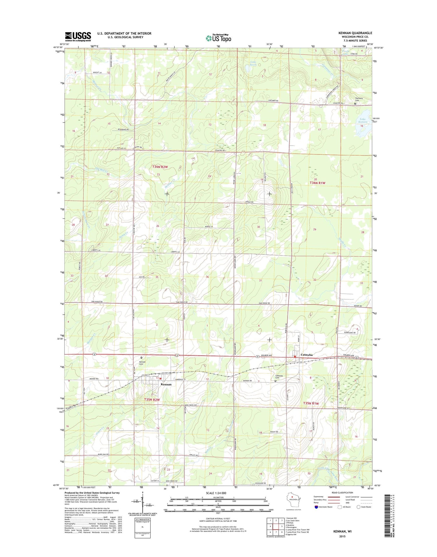
2018 topographic map quadrangle Kennan in the state of Wisconsin. Scale: 1:24000. Based on the newly updated USGS 7.5' US Topo map series, this map is in the following counties: Price. The map contains contour data, water features, and other items you are used to seeing on USGS maps, but also has updated roads and other features. This is the next generation of topographic maps. Printed on high-quality waterproof paper with UV fade-resistant inks.
Quads adjacent to this one:
West: Hawkins
Northwest: Kennan NW
North: Lac Sault Dore
Northeast: Phillips
East: Pennington
Southeast: Ogema NW
South: Jump River Fire Tower NE
Southwest: Jump River Fire Tower NW
Contains the following named places: Bolger 2WP266 Dam, Catawba, Catawba - Harmony Volunteer Fire Department, Catawba Cemetery, Catawba Middle School, Catawba Post Office, Forest Vale School, Georgetown Townhall, Harmony Cemetery, Harmony Lookout Tower, Johnston School, Kennan, Kennan - Georgetown Volunteer Fire Department, Kennan Cemetery, Kennan Elementary School, Kennan Post Office, Lake Seven, Martins Hill School, Old Mill School, Saint Paul Church, Town of Georgetown, Village of Catawba, Village of Kennan, ZIP Code: 54537


