MyTopo
King Wisconsin US Topo Map
Couldn't load pickup availability
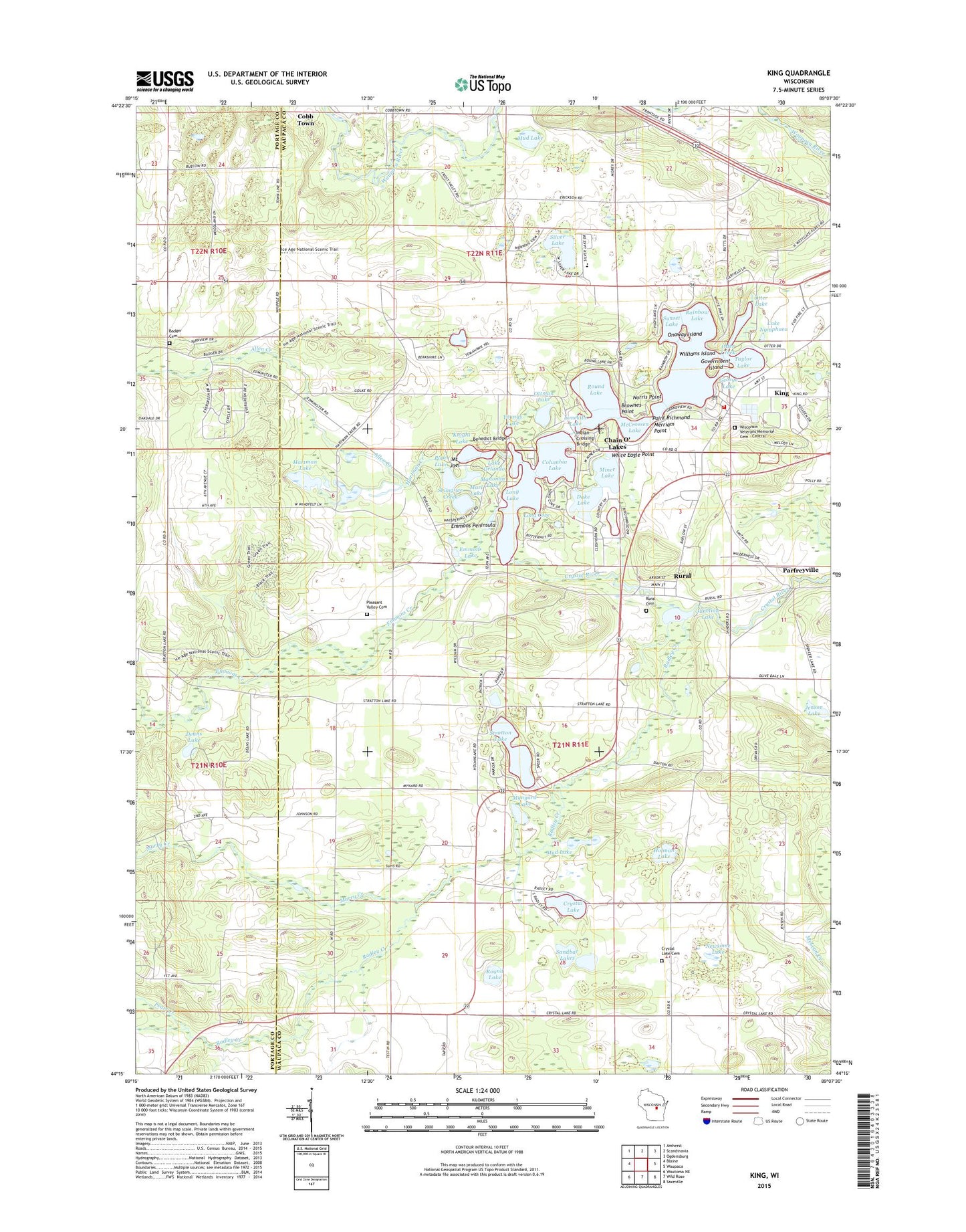
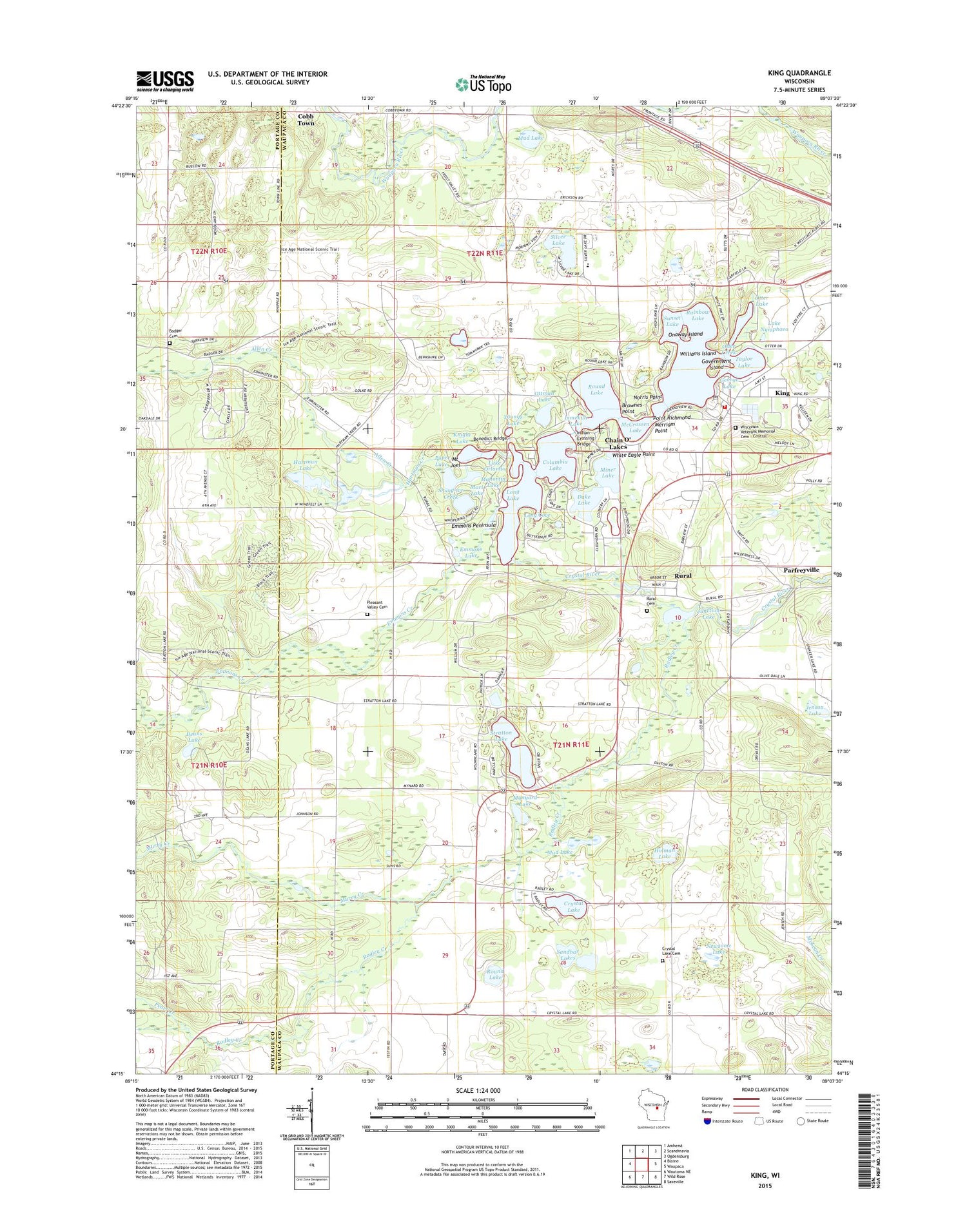
2018 topographic map quadrangle King in the state of Wisconsin. Scale: 1:24000. Based on the newly updated USGS 7.5' US Topo map series, this map is in the following counties: Waupaca, Portage. The map contains contour data, water features, and other items you are used to seeing on USGS maps, but also has updated roads and other features. This is the next generation of topographic maps. Printed on high-quality waterproof paper with UV fade-resistant inks.
Quads adjacent to this one:
West: Blaine
Northwest: Amherst
North: Scandinavia
Northeast: Ogdensburg
East: Waupaca
Southeast: Saxeville
South: Wild Rose
Southwest: Wautoma NE
Contains the following named places: Allen Creek, Badger Cemetery, Badger School, Barton School, Beasley Lake, Benedict Bridge, Brownes Point, Camp Onaway, Central Wisconsin Veterans Memorial Cemetery, Chain O' Lakes, Chain O' Lakes Census Designated Place, Chain O' Lakes Elementary School, Chain O' Lakes-King Census Designated Place, Columbia Lake, Crystal Lake, Crystal Lake Cemetery, Crystal Lake Church, Crystal Lake Corners, Dake Lake, Deans Lake, Dopp School, Edmunds Dock, Emmons Creek, Emmons Creek Barrens State Natural Area, Emmons Lake, Emmons Peninsula, George Lake, Government Island, Greenwood Forest, Hartman Creek, Hartman Creek Number Five Dam, Hartman Creek Number One Dam, Hartman Creek State Park, Hartman Lake, Hartman Lake 2, Hartman Lake 3, Holman Lake, Indian Crossing, Indian Crossing Bridge, Jenson Lake, Junction Lake, King, King Post Office, Knight Lake, Lake Nymphaea, Lake Orlando, Limekiln Lake, Long Cove, Long Lake, Loyola Villa, Manomin Lake, Marl Lake, McCrossen Lake, Merriam Point, Miner Lake, Mount Joel, Mud Lake, Mud Lake-Radley Creek Savanna State Natural Area, Murry Creek, Mynyard Lake, Nessling Lake, Newsome Lake, Norris Point, Onaway Island, Otter Creek, Otter Lake, Ottman Lake, Parfreyville, Pearl Creek, Pleasant Valley Cemetery, Point Richmond, Pope Lake, Pope Lake State Natural Area, Radley Creek, Rainbow Lake, Round Lake, Rural, Rural Cemetery, Sandbar Lakes, Sherman School, Shung-we Creek, Silver Lake, Stratton Lake, Sunset Lake, Taylor Lake, Tomorrow's Children School, Town of Dayton, Town of Farmington, Waupaca Boys Camp, White Eagle Point, Williams Island, Wisconsin Veterans Home - King Fire Department, Youngs Lake, ZIP Codes: 54946, 54981