MyTopo
Blaine Wisconsin US Topo Map
Couldn't load pickup availability
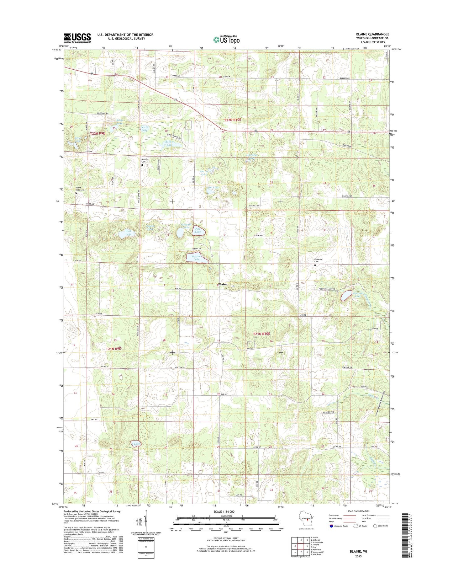
2022 topographic map quadrangle Blaine in the state of Wisconsin. Scale: 1:24000. Based on the newly updated USGS 7.5' US Topo map series, this map is in the following counties: Portage. The map contains contour data, water features, and other items you are used to seeing on USGS maps, but also has updated roads and other features. This is the next generation of topographic maps. Printed on high-quality waterproof paper with UV fade-resistant inks.
Quads adjacent to this one:
West: Almond
Northwest: Arnott
North: Amherst
Northeast: Scandinavia
East: King
Southeast: Wild Rose
South: Wautoma NE
Southwest: Plainfield
This map covers the same area as the classic USGS quad with code o44089c3.
Contains the following named places: Blaine, Boelter Lake, Buena Vista Cemetery, East Lake, Elmwood Cemetery, Fountain Lake, Fountain Lake Dam, Hillside Cemetery, Huntleys Lake, Jim Lake, Lincoln School, Madley School, Peters Lake, Pickerel Lake, Pickerel Lake State Natural Area, Pierces Lake, Pine Lake, Pleasant Lake, Poplar Lake, Riley Lake, Saint Patricks Church, Silver Lake, Sunnyview School, Town of Belmont, Town of Lanark, Wolf Lake, ZIP Code: 54909