
MyTopo
Lac du Flambeau SW Wisconsin US Topo Map
Couldn't load pickup availability
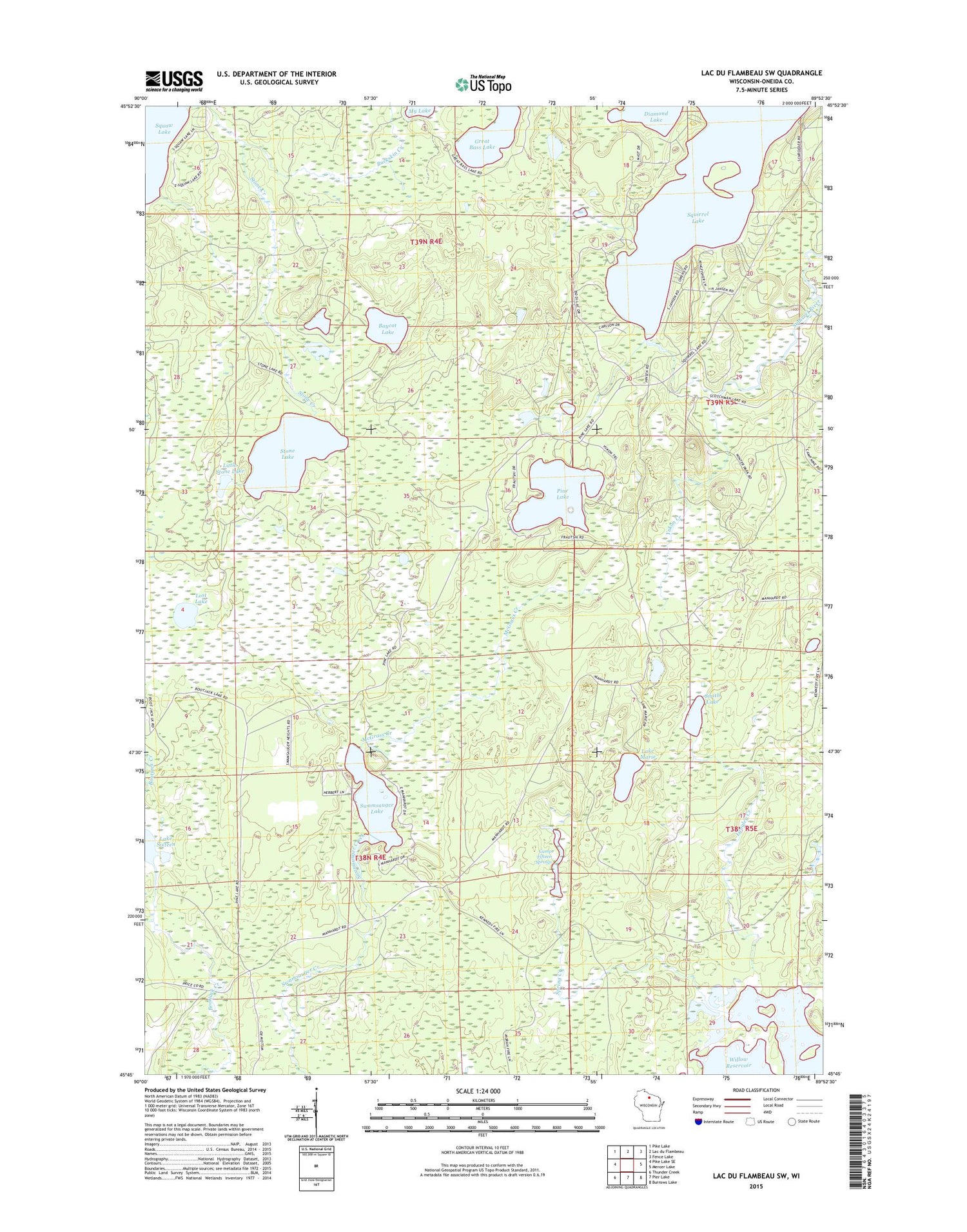
2018 topographic map quadrangle Lac du Flambeau SW in the state of Wisconsin. Scale: 1:24000. Based on the newly updated USGS 7.5' US Topo map series, this map is in the following counties: Oneida. The map contains contour data, water features, and other items you are used to seeing on USGS maps, but also has updated roads and other features. This is the next generation of topographic maps. Printed on high-quality waterproof paper with UV fade-resistant inks.
Quads adjacent to this one:
West: Pike Lake SE
Northwest: Pike Lake
North: Lac du Flambeau
Northeast: Fence Lake
East: Mercer Lake
Southeast: Burrows Lake
South: Pier Lake
Southwest: Thunder Creek
Contains the following named places: Baycat Lake, Buckskin Creek, Camp Fifteen Springs, Diamond Lake, Great Bass Lake, Lake Marie, Lake Sixteen, Langley Creek, Little Stone Lake, Lost Lake, McGrass Creek, My Lake, Pine Lake, Smith Lake, Spring Creek, Squirrel Hill Lookout Tower, Squirrel Lake, Stone Creek, Stone Lake, Swamsauger Lake, Town of Minocqua, Yukon Creek


